Contents:
How to build a trip through Issyk-Kul Region
Issyk-Kul Region extends far beyond the beach. It covers the lake, towns on the ring road, valleys in the northern and southern ranges, and remote high mountains along the Chinese border. Karakol is the administrative centre, but no single base works for the whole region.
Begin by deciding what should anchor the trip. Use our separate guide to Lake Issyk-Kul for swimming and shore choice. Open the Issyk-Kul road trip for a full driving loop. This regional guide helps you choose bases and understand which parts of the region combine sensibly.
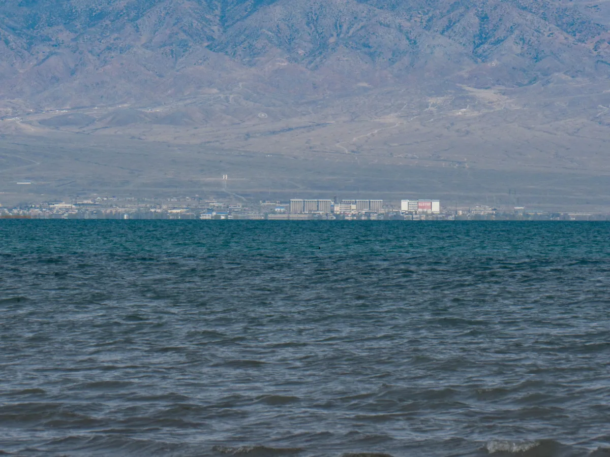 1/4. Balykchy: arrival and connections Photo: Nikolai Bulykin, Wikimedia Commons, CC BY-SA 4.0; edited for this site.
 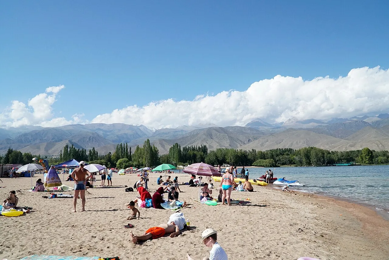 2/4. Cholpon-Ata: a resort base Photo: Adam Harangozó, Wikimedia Commons, CC BY-SA 4.0; edited for this site.
 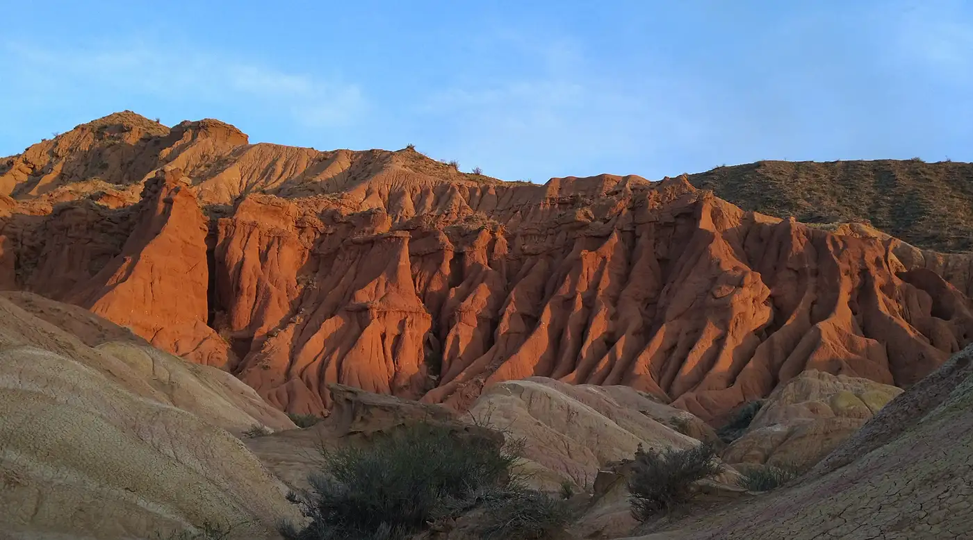 3/4. The south shore: canyons and road stops
 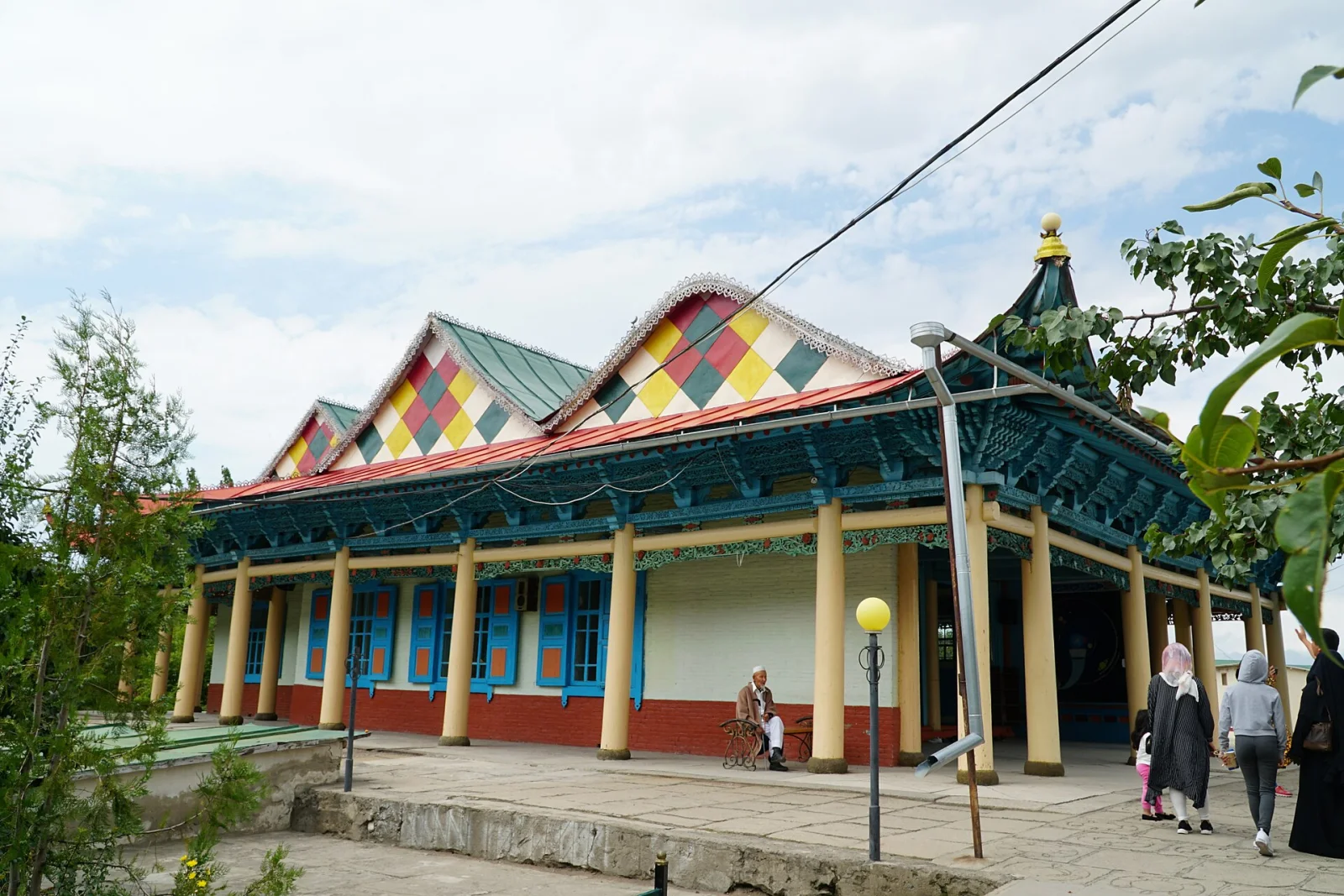 4/4. Karakol: town and mountain routes Photo: Adam Harangozó, Wikimedia Commons, CC BY-SA 4.0; edited for this site.
 The useful rule is one base for one part of the region. Cholpon-Ata is impractical for daily trips to Barskoon, while Bokonbaevo is a poor base for Karakol treks. Treat a move between shores as a real part of the day, especially when a canyon, valley or museum sits along the route.
Four bases and travel zones
Balykchy. This is the western gateway to the region and the junction for the north and south shore roads. It works for a change from train or bus, an overnight after a late arrival and onward travel to Naryn Region. Choose another base for a beach holiday or repeated day trips.
Cholpon-Ata and Bosteri. This area makes it easy to combine beaches, cafes, cultural sights and short northern outings. From Cholpon-Ata you can reach the petroglyphs, Rukh Ordo, Grigorievka Gorge or Semenovka Gorge. Summer is busier here, so check accommodation, transfers and room noise before paying.
Bokonbaevo, Kadji-Sai, Tamga and Barskoon. These settlements form a chain of practical south-shore bases. Bokonbaevo suits the western section and Ak-Sai Canyons, Kadji-Sai and Tosor work for shorter road stops, while Tamga and Barskoon shorten the journey to the waterfalls. Guesthouses and yurt camps are more common choices here than large resorts.
Karakol. This is the main town base in the east and the regional capital. Give the mosque, cathedral, bazaar and museums their own day, then add one mountain outing at a time. Karakol is not on the beach, so swimming requires a separate journey to the lakeshore.
Region and lake: the administrative region and the lake share a name but answer different travel questions. The lake guide helps with beaches and shores. The regional guide matches bases with valleys and long transfers.
What to see from each part of the region
North shore. Use it for a resort day, archaeology and one mountain outing. In Cholpon-Ata, the petroglyph field combines naturally with Rukh Ordo. For scenery, choose either Grigorievka Gorge or Semenovka Gorge. Do not make the unpaved crossing between them a compulsory part of the day.
South shore. The sights form a chain of road stops. Ak-Sai Canyons lie closer to the west, Skazka Canyon fits between Bokonbaevo and Tamga, and Barskoon needs time for a waterfall walk. Do not force all three into one day: dirt approaches, heat and weather quickly use up the margin.
Eastern section. Karakol links a town day with Jeti-Oguz, Ak-Suu, Altyn-Arashan, Karakol Gorge and winter skiing. A short drive to red rock formations and a multi-day crossing over Ala-Kul Pass require completely different preparation. Choose the level before arranging transport and accommodation.
The approach through On-Tor Gorge gives close views of Karakol Peak, but even reaching its foot takes several days. The summit is a technical mountaineering objective and is not part of an ordinary trekking programme from Karakol.
Far east. Sary-Jaz, Enilchek, the glaciers, Merzbacher Lake, Khan Tengri and Victory Peak belong to remote high-mountain country. This area requires border documents, suitable vehicles, spare time and organised logistics. It does not work as an extension to an ordinary Karakol day trip.
Mountain trips from Karakol by difficulty
A straightforward day. Start with Jeti-Oguz: the red rocks are accessible by an ordinary road, and you can add Kök-Jaiyk if weather and ground conditions allow. This outing leaves energy for town and suits travellers who are not planning a high-altitude trek.
A full day or overnight. Altyn-Arashan needs either a substantial walk or a capable off-road transfer. The valley works well for an overnight, the hot springs and the start of a longer route. Do not place it after a six-hour transfer from Bishkek.
A multi-day trek. Ala-Kul links Karakol Gorge, the high lake, a pass and Altyn-Arashan. Even in the main season, it requires equipment, weather margin and an understanding of altitude. It is an independent section of a holiday, not a day stop within the lake loop.
An expedition-level journey. The road to Enilchek crosses Chon-Ashuu Pass and a border zone. A separate multi-day expedition continues from there towards Merzbacher Lake. Avalanche danger remains on the road in late winter and spring, so use a current report rather than last year's opening date.
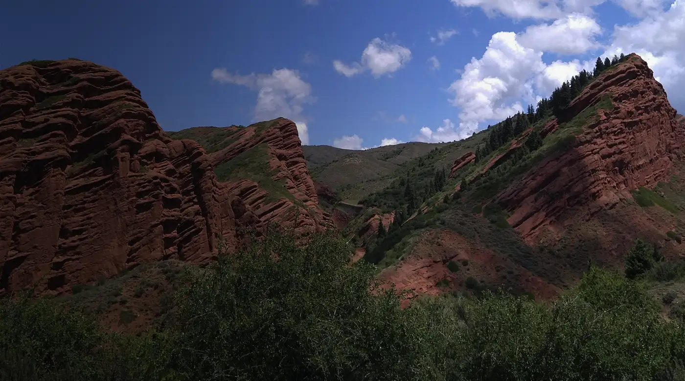 1/4. Jeti-Oguz for a first mountain day
 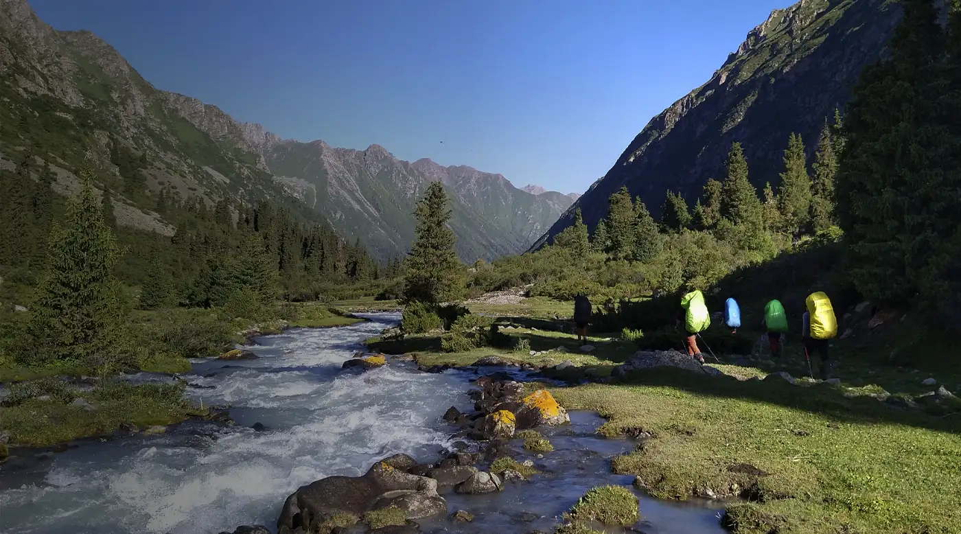 2/4. Altyn-Arashan: a full day or overnight
 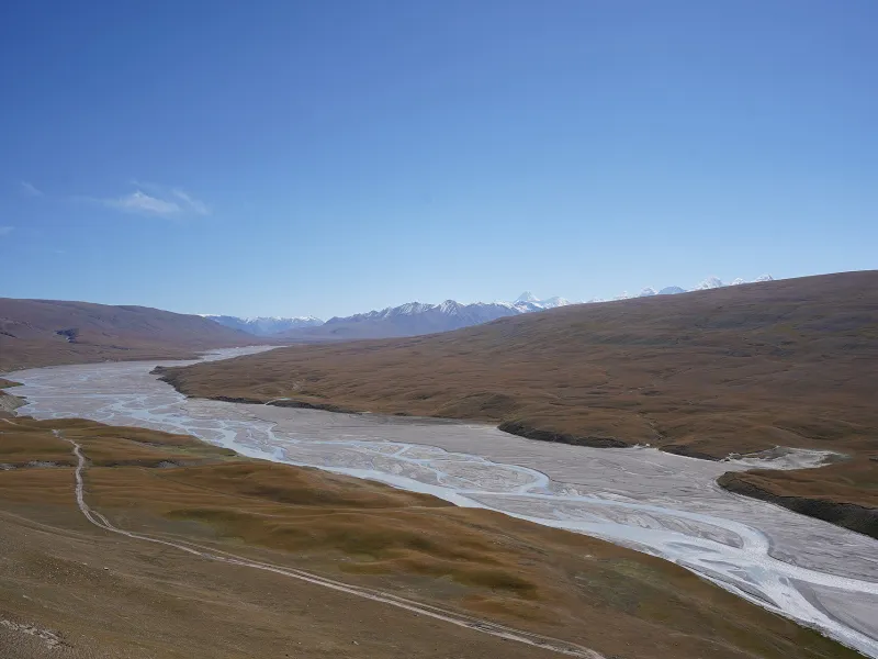 3/4. Sary-Jaz beyond Chon-Ashuu Pass Photo: Nadine Hitz, Wikimedia Commons, CC BY-SA 4.0; edited for this site.
 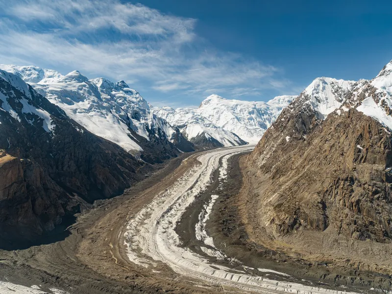 4/4. The region’s glaciated high mountains Photo: Maryliflower, Wikimedia Commons, CC BY-SA 4.0; edited for this site.
 Getting around Issyk-Kul Region
Buses, minibuses and shared taxis connect Bishkek with Balykchy, Cholpon-Ata, Bokonbaevo, Karakol and larger settlements on both shores. Check the direction and terminus in the official bus-station timetable before travelling. A service to Barskoon or Jeti-Oguz District does not necessarily enter the valley, canyon or trailhead.
Without your own car, build the trip around two bases and hire transport for individual outings. Agree the whole-vehicle price, waiting time, turnaround point and return time with the driver. A new taxi may not be available at a remote valley, and mobile coverage often ends before the road does.
A sound ordinary car is enough for the main road around the lake. High clearance and four-wheel drive are useful on particular dirt branches, but they do not make a muddy rut or unknown ford safe. Work continued on the Balykchy - Barskoon - Karakol road in 2026, so check the latest Ministry of Transport updates and allow for lane restrictions and diversions.
The seasonal train to Rybachye station terminates in Balykchy. Issyk-Kul and Karakol airports may shorten a long transfer, but you must check flights and onward transport for the actual date. Our guides to the Bishkek-Balykchy train and Kyrgyzstan's airports explain where to verify tickets.
Where to stay and what to eat
On the north shore, accommodation and food choices are broadest in summer. Check the actual beach entrance, road crossings, nearby music venues and off-season kitchen hours alongside the stated distance to the water.
On the south shore, a guesthouse often solves three problems at once: a bed, breakfast and help with a car. Before booking, ask about hot water, heating, dinner, cash payment and the exact turn from the main road. Confirm the operating season and distance to the nearest settlement for a yurt camp.
In Karakol, stay within walking distance of the centre for town life or closer to the southern exit if the mountains are the priority. Luggage storage, an early breakfast, somewhere to dry clothes and a confirmed vehicle to the trailhead are particularly useful before a trek.
Leave room in Karakol for ashlyam-fu, Dungan cooking and the bazaar. In a small village, ordering dinner with the room is more reliable than looking for a cafe after dark. Carry water and a snack even with a meal booked, as roadworks or rain in a valley can easily delay arrival.
When to visit Issyk-Kul Region
Spring
Towns and lower canyons open earlier than the passes, while high mountains remain in winter conditions.
- Visit the southern canyons only in dry weather.
- Avalanche risk remains on Chon-Ashuu.
- Beach cafes and camps operate selectively.
Summer
This is the main season for beaches, guesthouses, yurt camps and most lower valleys.
- July and August make the north shore much busier.
- Snow can remain on passes in early summer.
- Thunderstorms and heavy rain change dirt approaches within hours.
Autumn
The lakeshore becomes quieter, but seasonal businesses close before the main mountain roads do.
- September suits the loop and lower valleys.
- High-altitude trips require current snow information.
- Daylight and the safe return window become shorter.
Winter
Karakol works as a winter base, while the shore and remote valleys need a dedicated plan.
- Check ski-area opening and the approach road.
- Some lakeside accommodation and cafes close.
- Snow and avalanche danger can close the Enilchek road.
A Cholpon-Ata forecast does not describe Altyn-Arashan, and a Karakol forecast does not replace a pass report. Check the precise mountain point, precipitation, wind and road condition for each outing. Our guide to Kyrgyzstan's climate explains the broader seasonal pattern.
Practical trip outlines
One resort base
- Stay in Cholpon-Ata or Bosteri.
- Keep one day for the beach and town.
- Use one day for the petroglyphs or a northern gorge.
- Return without crossing to the other shore.
Karakol and one outing
- Use the first day for town and the bazaar.
- Choose Jeti-Oguz or Altyn-Arashan for day two.
- Keep the third morning for a museum or onward travel.
- Leave a high-altitude trek out of the compressed plan.
North shore and Karakol
- Use Balykchy as the entry point.
- Stay one or two nights on the north shore.
- Spend two nights in Karakol.
- Choose one valley from each base.
Both shores without rushing
- Combine the north shore, Karakol and a southern base.
- Keep one complete town day.
- Choose two independent nature outings.
- Use the separate road guide for the loop order.
If an Ala-Kul trek takes three to four days, add those days to the outline instead of squeezing them inside it. Enilchek and the glacier country need their own preparation and margin. A sound regional itinerary leaves one day for weather, rest or an unhurried transfer.
What to check before leaving
The role of each overnight. Write down the two or three objectives served by each base. Change the accommodation before paying if every destination lies in another part of the region.
The final approach. Save the guesthouse, car park and trailhead as separate coordinates. The name of a village or valley does not tell you where the asphalt ends.
Return transport. Confirm the last service or agree a waiting time with a driver. Do not build the return around finding a random vehicle where there is no coverage.
Border documents. Start the permit process early for Sary-Jaz, Enilchek and parts of the far east. Check the precise areas and dates on the permit, carry the original passport and leave a spare day.
Road and weather. Compare conditions at the lake, in town and at the mountain destination. Leave a dry canyon or unknown ford after heavy rain. Do not continue towards a pass after snowfall without confirmation that the road is open.
Money and coverage. Carry cash, an offline map, a charged phone and the number of the next accommodation. A small cafe may lack a card terminal, while a mobile transfer may fail without a signal.
Share on social media
If you found this guide useful, share it on social media. It takes a moment and helps more travellers discover the project. Thank you!
Anything to add?
Share your experience, leave a comment or suggest an improvement.