Contents:
How the Cholpon-Ata petroglyph museum works
This is an archaeological field, not a gallery of relocated objects. The images remain on the boulders where people from different periods made them. Walking routes weave between the stones, so a visit feels more like a walk through an open monument than an ordinary museum tour.
To compare this stone field with Saimaluu-Tash and Sulaiman-Too, begin with our overview of petroglyphs in Kyrgyzstan.
Research describes an area of about 42 hectares. The site belongs to the Issyk-Kul State Historical and Cultural Museum-Reserve and officially operates as the open-air museum of Cholpon-Ata.
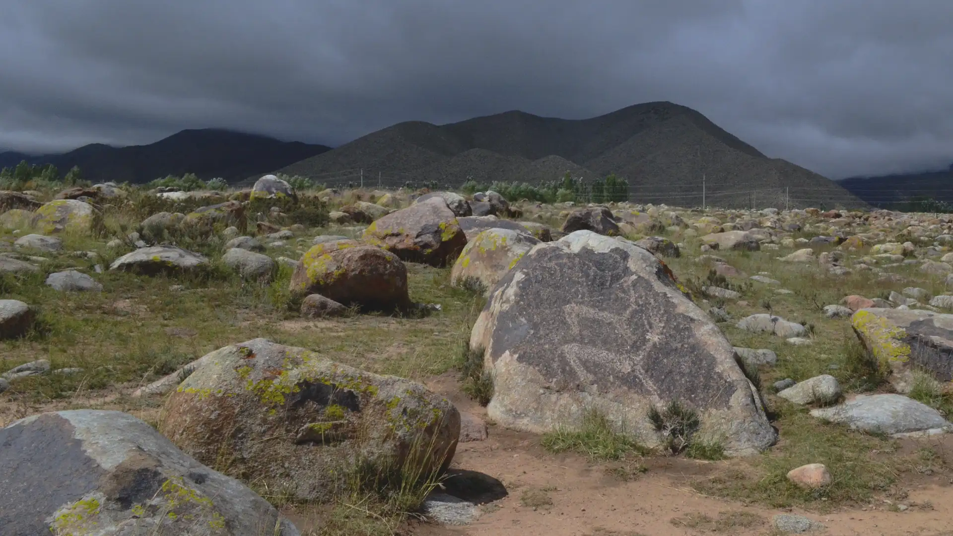
The setting gives the place much of its value. Stone circles, burial structures, balbals and fragments of stone walls remain beside the images. Together, they reveal an archaeological landscape on the northern shore of Issyk-Kul, not merely a collection of separate drawings.
Getting there and preparing for the walk
The entrance is on the north-western edge of Cholpon-Ata. Open the exact point through 2GIS, Google Maps or Yandex Maps at the top of this page. Journey time depends on your starting point and summer traffic in town.
You explore the site on foot. The trail crosses uneven ground between boulders, with little shade. Bring closed shoes, water, a hat and sun protection. After rain and in winter, watch your footing: wet stones, snow and ice make the walk harder and may hide some images.
Opening hours, guided-tour availability and admission prices may change. Check with the museum or a current listing on the day of your visit. Allow between 40 minutes and two hours, depending on the circuit and how closely you examine the stones.
What appears on the stones, and how old are the images?
A petroglyph is an image pecked, scratched or cut into a rock surface. It is not paint. Ancient lines appear lighter than the dark patina on the boulders, so the image is easiest to see in side light.
The Cholpon-Ata petroglyphs do not share a single date. An archaeological review published in 2022 assigns the studied images to the Bronze and Iron Ages, the Turkic period and the Middle Ages. The stone field remained in use for a long time, with new images appearing beside older ones.
Wild goats, deer, bulls, camels, predators and hunting scenes are the most common subjects. Animals were rendered as outlines, fine lines or denser silhouettes. These differences help archaeologists compare images and suggest a period, but they do not provide a ready explanation for every scene.
One comparative study documented 409 petroglyphs at the site, including 285 images of goats. This figure describes a particular catalogue, not a final total for the whole museum. Claims that visitors will see "5,000 drawings" are misleading. Thousands of stones lie here, but not every stone carries a petroglyph.
Do not automatically interpret every image as a religious rite or a sign of the Silk Road. Subject, technique and nearby archaeological remains give researchers material for interpretation, but the precise meaning of many images is unknown.
Choosing a trail through the museum
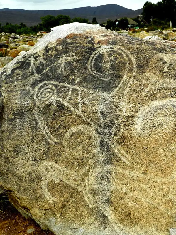 1/4. Animal figures in a petroglyph
 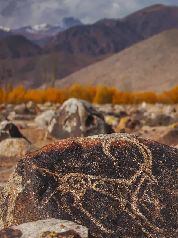 2/4. A goat on the dark stone surface
 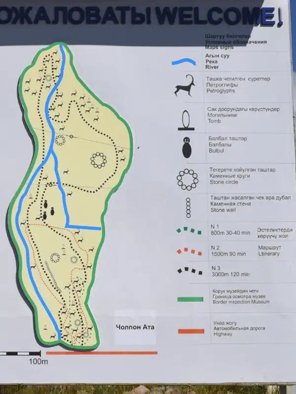 3/4. Trail plan at the entrance
 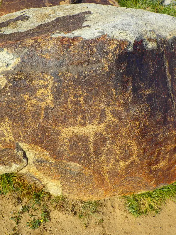 4/4. Petroglyphs on a boulder
 The plan at the entrance marks three walking circuits. The short route offers a quick introduction, the middle route covers more types of monument, and the long route crosses a substantial part of the stone field.
Route 1: 800 m, 30 to 40 minutes. A short circuit past the main objects.
Route 2: 1,500 m, about 90 minutes. A relaxed walk without completing the full circuit of the field.
Route 3: 3,000 m, about 120 minutes. The long circuit for a more detailed look at the complex.
Begin with the short route and continue if you have enough time and energy. The local plan uses separate symbols for petroglyphs, burial structures, balbals, stone circles and walls. Markings may change, so compare your route with the current map at the entrance before setting off.
Soft side light in the morning or towards evening is best for photography because it emphasises the contrast between the dark patina and pecked lines. Do not pour water, apply chalk or use other substances to increase the contrast.
Protecting the petroglyphs and understanding the UNESCO status
Do not step on stones with images, touch the lines or climb boulders for a photograph. Stay on the marked path and make sure children do not treat the archaeological field as a climbing area. Even inconspicuous scratches and repeated touching accelerate damage to the surface.
In 2000, the UNESCO World Heritage Centre approved assistance to Kyrgyzstan for preparing a nomination dossier for the Cholpon-Ata petroglyphs. The UNESCO project page says that the work was only partly completed and the process was closed. Preparing a nomination is not the same as inscription on the World Heritage List, so the museum should not be described as a UNESCO site.
The monument has state protection regardless of the unfinished nomination. It belongs to the Issyk-Kul State Historical and Cultural Museum-Reserve. For a visitor, the rule is simple: observe the traces that are here, and leave none of your own.
After the walk, continue exploring the culture of the northern shore at Rukh Ordo or choose another stop from our guide to museums in Kyrgyzstan.
Share on social media
If you found this guide useful, share it on social media. It takes a moment and helps more travellers discover the project. Thank you!
Anything to add?
Share your experience, leave a comment or suggest an improvement.