Contents:
How to organise a trip through Osh Region
Osh Region changes altitude and character very quickly. The populated Fergana lowlands fill its northwestern side, the main road climbs south over Chyiyrchyk and Taldyk passes into Alay, and Chon-Alay then extends west along the Trans-Alay Range. One hotel address cannot serve the whole region.
For planning, divide the region into four corridors: the lowlands around Osh, Uzgen and the northeast, the road through Gulcha into Alay, then Sary-Mogol and Chon-Alay. Choose one corridor for a two-day visit. Allow at least three days for Alay with an overnight stay and more for remote valleys.
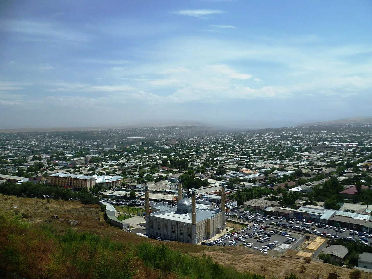 1/3. Osh, the main gateway to the region Photo: Radosław Botev, Wikimedia Commons, CC BY 3.0 PL; edited for this site.
 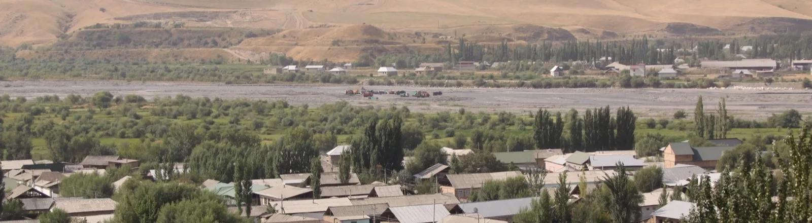 2/3. Uzgen and the Kara-Darya valley Photo: JohnNewton8, Wikimedia Commons, CC BY-SA 4.0; edited for this site.
 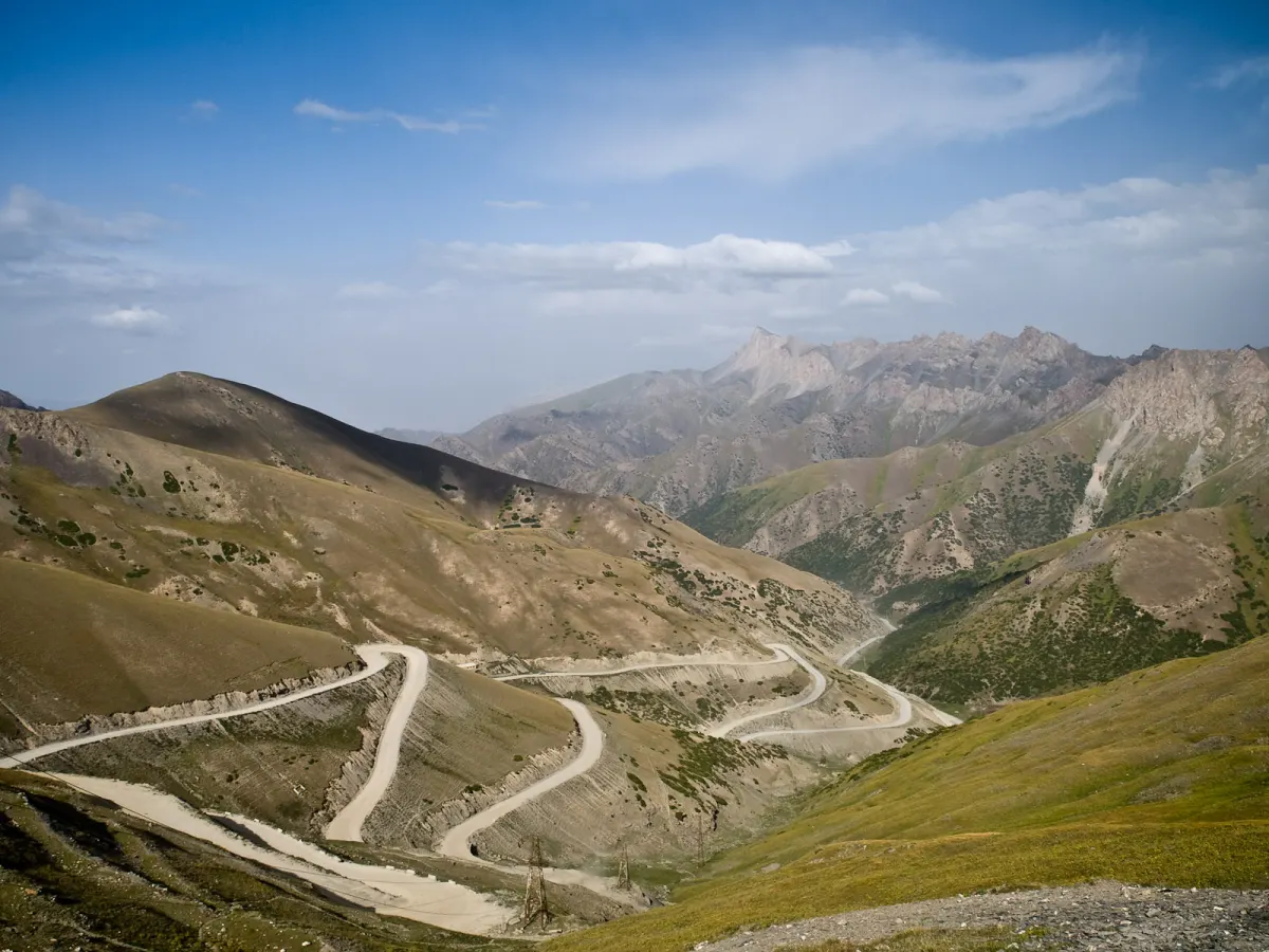 3/3. The road over Taldyk Pass Photo: Gustavo Jeronimo, Wikimedia Commons, CC BY 2.0; edited for this site.
 Osh city has separate status: it is a city of republican significance and the region's administrative centre, but is not formally part of Osh Region. For travellers it remains the main transport hub, first-night base and starting point for almost every route.
The bazaar, city walks and Sulaiman-Too belong in the separate Osh city guide. We also cover the Sulaiman-Too walking route and its museum complex on dedicated pages. Here, Osh matters primarily as a base for exploring the region.
Where to base yourself
Osh. The best base for the first night, city walks, Uzgen, Kara-Suu, Papan and the western lowlands. It has the widest choice of hotels, late meals, cash machines and drivers. Osh works as the start of an Alay trip, but daily returns from Sary-Mogol would waste many hours.
Uzgen. A useful overnight stop if you want time for the architectural complex and market before continuing toward Kara-Kulja, Kara-Shoro or another prearranged destination in the northeast. A day trip from Osh is enough if Uzgen is your only objective.
Gulcha. A practical intermediate base before Taldyk Pass and local valleys in Alay District. Stay when you have a specific guesthouse or an outing with a local guide. Ordinary transit passengers will usually save time by continuing to Sary-Tash before dark.
Sary-Tash. The road junction beyond Taldyk, where routes split toward Irkeshtam, Sary-Mogol and Chon-Alay. The village suits a transit night, an early departure and a weather check. Services are limited, so confirm both the room and dinner.
Sary-Mogol. The main visitor base for the northern Trans-Alay Range, Tulpar-Kol and the road to camps below Lenin Peak. It removes several hours of backtracking and makes an early morning walk possible, when mountain views are often clearer.
The lowlands around Osh
Kara-Suu, Aravan and Nookat follow the rhythm of the Fergana Valley: markets, orchards, village roads and dense settlements matter more than a checklist of viewpoints. Pick one purpose instead of driving a circuit through every district centre. Our Kara-Suu guide helps you decide whether its market and urban life fit the trip.
Papan Reservoir lies south of Osh. It can make a scenic drive when you have chosen an exact viewpoint, but it is not an organised beach. Shore access, technical zones and road surfaces vary, so do not build the day around an arbitrary pin on a map.
Kyrgyz-Ata near Nookat and Abshyr-Ata west of Osh require separate drives. The former leads into a mountain valley for walks; the latter is known for its gorge and waterfall. Ask about the final road after rain and leave early on weekends before popular access points fill with cars.
Uzgen and the northeast
Uzgen is roughly 55 kilometres from Osh and deserves its own day. The architectural complex, market and rice culture are covered in our Uzgen guide. On a regional itinerary, the city matters as a junction between the Kara-Darya valley, Kara-Kulja and more remote mountain routes.
Plan the Andijan, or Kempir-Abad, Reservoir as a separate border-area trip rather than a beach extension to a day in Uzgen. Choose a suitable viewpoint with a local driver and confirm access before leaving. Do not assume that the dam, service roads or border-area sections are open to visitors.
Kara-Shoro can be a long summer outing or an overnight stop with accommodation booked in advance. Kulun Lake and higher routes farther east need a local organiser, suitable vehicle and often a horse or hiking section. They are not quick additions to an Uzgen day: distance and altitude turn them into a separate expedition.
With one day, return from Uzgen to Osh. With three or more days and a reliable local contact, moving your base reveals the northeast without night driving. Record the meeting point, meals, communication plan and return time before departure.
The road into Alay over Chyiyrchyk and Taldyk
The main road leaves Osh through Gulcha, crosses the 2,406-metre Chyiyrchyk Pass and 3,615-metre Taldyk Pass, then reaches Sary-Tash. A paved trunk road is still a mountain road: fog, snow, rockfall or mudflow debris can change the journey time quickly.
Beyond Taldyk, the broad Alay Valley opens with the Trans-Alay Range to the south. Geographically this is the Pamir-Alay, so describing all of Kyrgyzstan only through the Tian Shan misses an important distinction. Stop only in broad pull-offs, never on a switchback.
The road gains altitude quickly. Keep the first evening in Sary-Tash or Sary-Mogol light, drink water and do not combine the long transfer with a strenuous hike. Headache, nausea, unusual weakness or impaired coordination call for less exertion and a reassessment, not determination to finish a prepaid plan.
Chon-Alay, Tulpar-Kol and the northern Trans-Alay Range
From Sary-Tash the road turns west through Sary-Mogol toward Daroot-Korgon. This is the main axis of Chon-Alay, used for village bases, horse treks and views of the Trans-Alay Range. Distances look short on a map, but turnoffs to lakes and camps are slower than the main road.
Tulpar-Kol is a system of small lakes among pastureland, with reflections of the snow peaks in clear weather. Water levels, grass colour and visibility change through the season. Ask your host for the route to the exact yurt camp: a generic Tulpar-Kol pin may lead to the wrong approach.
Travellers without summit ambitions also visit the base camps below Lenin Peak. The altitude, glacial terrain and weather still require respect. Acclimatisation, camp rules and mountaineering risks are covered on our Lenin Peak page; a regional itinerary is not an expedition plan.
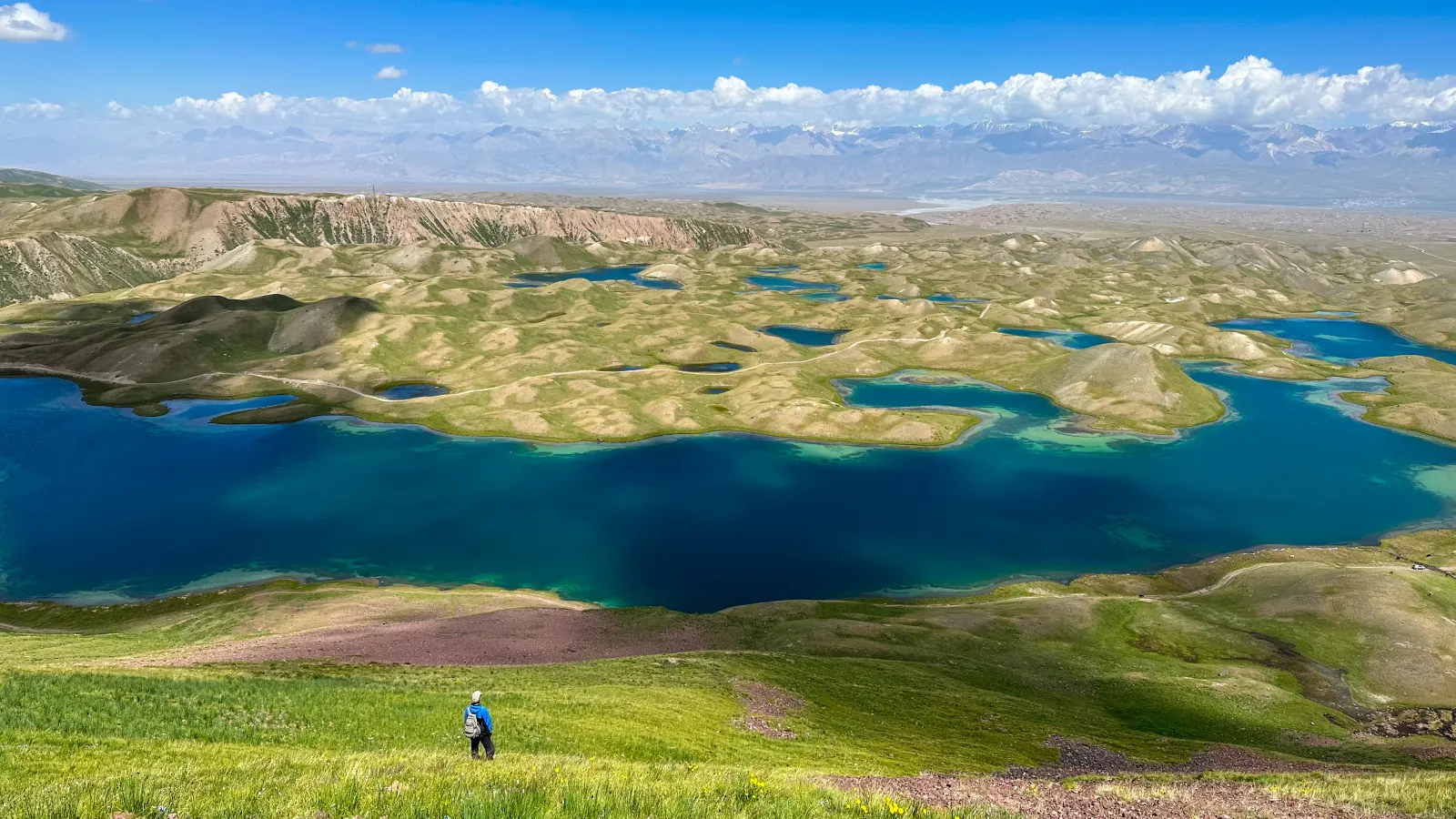 1/2. Tulpar-Kol near Sary-Mogol Photo: Atantai Tazhibaev, Wikimedia Commons, CC BY-SA 4.0; edited for this site.
 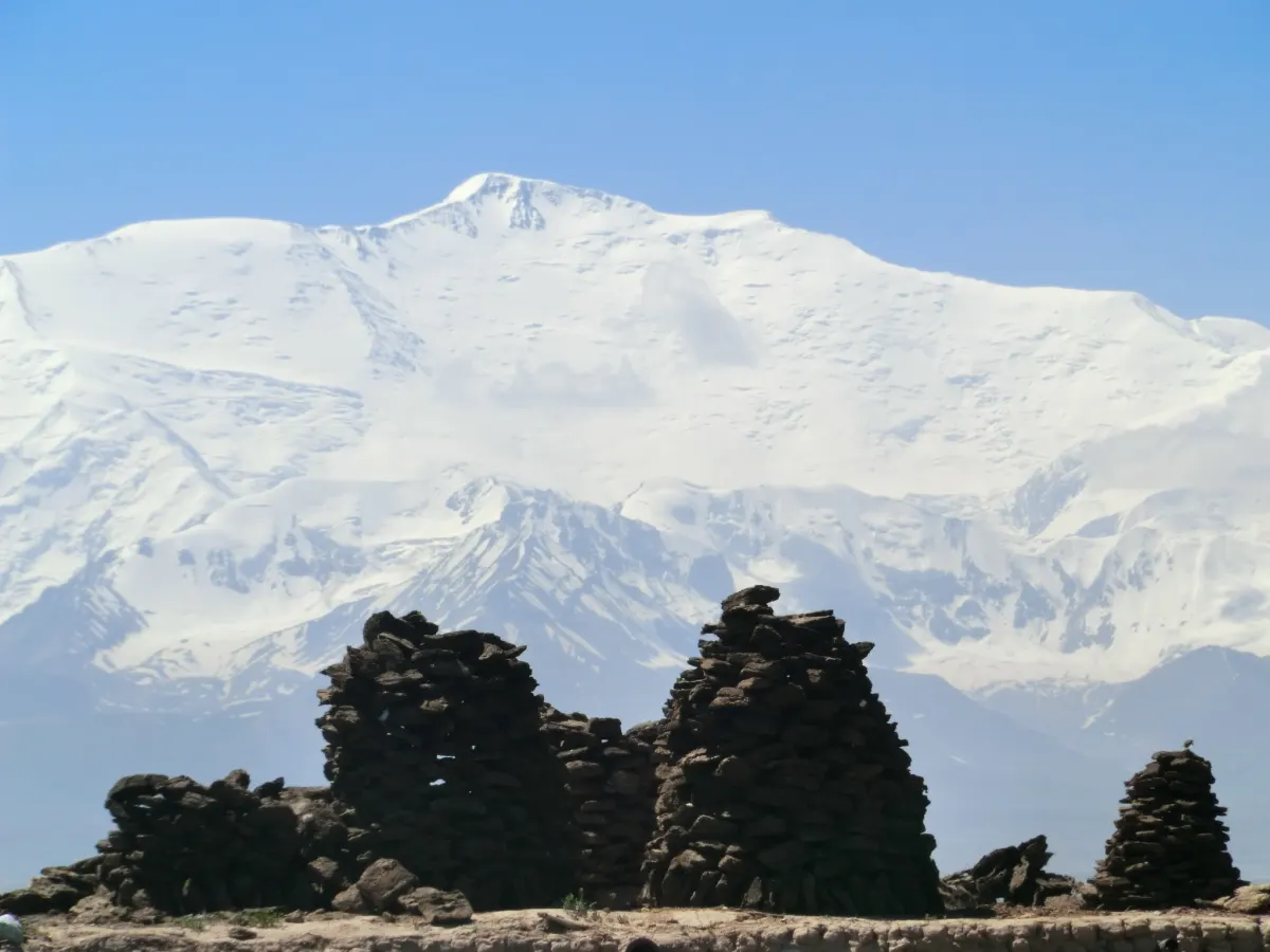 2/2. Lenin Peak from Sary-Mogol Photo: Nihongarden, Wikimedia Commons, CC BY-SA 3.0; edited for this site.
 Getting there and travelling around
Most visitors arrive through Osh. Its airport handles domestic and international routes, but the schedule changes with demand and season. Our guide to airports in Kyrgyzstan explains the difference between an existing airport and a flight you can actually book.
Minibuses and shared taxis connect Osh with Uzgen, Kara-Suu, Nookat, Gulcha and villages on the main road. Long-distance departures are less frequent and may arrive outside the centre. Check the route in the official bus-station timetable, then reconfirm it at the ticket office the day before.
Papan, Kyrgyz-Ata, Abshir-Ata, Kara-Shoro, Tulpar-Kol and the base camps usually need a private vehicle or local transfer. Agree on the final destination, waiting time, luggage, unpaved section and return. “Sary-Mogol village” and “a yurt camp by the lake” are different jobs.
Even the main highway remains weather-sensitive. In June 2026, a mudflow temporarily closed the Osh-Sary-Tash-Irkeshtam road before crews restored traffic. Ask about the road that morning, not only when you book.
Where to stay and eat
Osh has the broadest choice of hotels, guesthouses, restaurants and markets. If you arrive in the evening, eat and prepare cash before an early departure. Use the city guide for independent sightseeing; for the region, ask accommodation staff for a trusted driver and record the full terms in advance.
In Uzgen and Gulcha, book a specific place instead of looking after dark. Confirm parking, hot water, heating, early breakfast and card payment. A small guesthouse may cook dinner only when it is ordered ahead.
In Sary-Tash and Sary-Mogol, heating, a warm shower, meals and an exact location matter more than a formal hotel category. Ask whether dinner is included, if electricity runs overnight, where the toilet is and who will meet a late arrival. Carry cash and extra water.
In the lowlands, look for plov, samsa, lagman, manty, shashlik, fresh flatbread and seasonal fruit. Uzgen is particularly associated with rice and plov, but choose a restaurant locally by freshness and turnover. Food in Alay is simpler: order dinner from the hosts and pack bread, nuts, fruit and water for a day trip.
When to visit Osh Region
Spring
The lowlands turn green and flower before Alay, where snow and abrupt weather changes remain possible on the passes.
- Osh, Uzgen and lower valleys open earlier.
- Mountain guesthouses may operate by arrangement.
- Check mudflows and access roads after rain.
Summer
The main season for Taldyk, Sary-Mogol and high routes, although thunderstorms and mudflows remain possible.
- Book Alay accommodation ahead.
- Begin walks in the morning.
- Carry protection from sun, wind and cold.
Autumn
September often brings clear views and quieter roads, followed by a rapidly rising chance of snow on the passes.
- Shorten the day's driving.
- Confirm guesthouse heating.
- Do not schedule a tight connection after Taldyk.
Winter
The lowlands remain accessible, while Alay needs a winter-ready vehicle, flexible timing and a fresh road check.
- Monitor Chyiyrchyk and Taldyk.
- Do not improvise a winter version of a summer lake route.
- Carry extra time and warm clothing.
A forecast for Osh says little about Taldyk, Sary-Mogol or the Trans-Alay Range. Check several elevations separately. The main seasonal and altitude differences are explained in our guide to the climate of Kyrgyzstan.
Ready-made itineraries
Osh and Uzgen
- First day in Osh and on Sulaiman-Too.
- Overnight in Osh.
- A separate day for Uzgen and its market.
- Return without a remote mountain extension.
Osh and one valley
- City programme on arrival day.
- Choose Kyrgyz-Ata, Abshir-Ata or Papan.
- Vehicle with waiting time agreed.
- Road buffer after rain.
First visit to Alay
- Osh and preparation.
- Transfer over Taldyk to Sary-Tash.
- Night in Sary-Mogol.
- Tulpar-Kol and an unhurried return.
Alay and Chon-Alay
- Acclimatisation night after the passes.
- Sary-Mogol and Tulpar-Kol.
- Separate camp visit or horse-riding day.
- Continue to Daroot-Korgon with a local plan.
What to check before departure
End point. Write down whether the vehicle must reach Sary-Tash, Sary-Mogol, Tulpar-Kol, a camp below Lenin Peak or Daroot-Korgon. Each involves different roads, altitude and cost.
Road and weather. Check Chyiyrchyk, Taldyk and the final unpaved section that morning. After heavy rain, call the host or driver again.
Accommodation. Save the phone number and location; confirm dinner, heating, bathroom, late arrival and payment. In Alay, do not rely solely on an automated booking confirmation.
Altitude. Keep the first evening quiet. Do not hide symptoms to protect a prepaid excursion, and discuss the option of descending with the driver.
Communication and money. Download an offline map and carry cash, water, snacks, a warm layer and a charged power bank. Tell the hosts your estimated arrival time before the signal disappears.
Share on social media
If you found this guide useful, share it on social media. It takes a moment and helps more travellers discover the project. Thank you!
Anything to add?
Share your experience, leave a comment or suggest an improvement.