Contents:
- How many days you need
- The road from Osh
- Sary-Tash or Sary-Mogol
- Reaching Tulpar-Kul
- What to see and where to walk
- Whether you need a border permit
- Public transport and private cars
- Accommodation, food, cash and signal
- Season, weather and altitude
- Ready-made itineraries
- Pre-departure checklist
- Share and comment
How many days to allow for the Alay Valley
Three days is the shortest sensible plan: travel from Osh and sleep in Sary-Mogol, spend a day at Tulpar-Kul, then return. Four days let you avoid going straight to 3,500 metres, wait for a clear morning and keep road time flexible. A day trip from Osh turns the valley into a long drive with almost no walking.
This guide covers the main valley road, the choice of base and access to the lake. Our overview of Osh Region helps combine Alay with Uzgen and other areas, while the Lenin Peak guide separately explains Achik-Tash, glacial terrain and a high-altitude expedition. Those are different travel plans.
The Alay Range forms the northern wall of the valley and the Trans-Alay Range rises to the south. The Kyzyl-Suu river and the main road run along its broad floor. Geographically this is the Pamir-Alay rather than the Tian Shan, a distinction explained in our mountain geography guide.
The road from Osh through Gulcha and Taldyk Pass
Sary-Mogol is about 220 kilometres from Osh. The road passes Gulcha, climbs over 3,615-metre Taldyk Pass, descends to Sary-Tash and turns west. Driving without long stops commonly takes about four hours, but roadworks, mist, debris flows and viewpoint stops can make it longer.
The Taldyk switchbacks are spectacular, but stop only in a broad pull-off completely clear of traffic. Do not stand on a bend for a photograph or ask a driver to wait where an approaching vehicle cannot see the car. After heavy rain or snow, get a same-day road update before leaving.
The landscape changes abruptly beyond the pass. The confined road opens onto the flat Alay floor and the long snowy face of the Trans-Alay Range. Morning often gives the better chance of clear peaks. A night in the valley provides a second opportunity if evening cloud hides them.
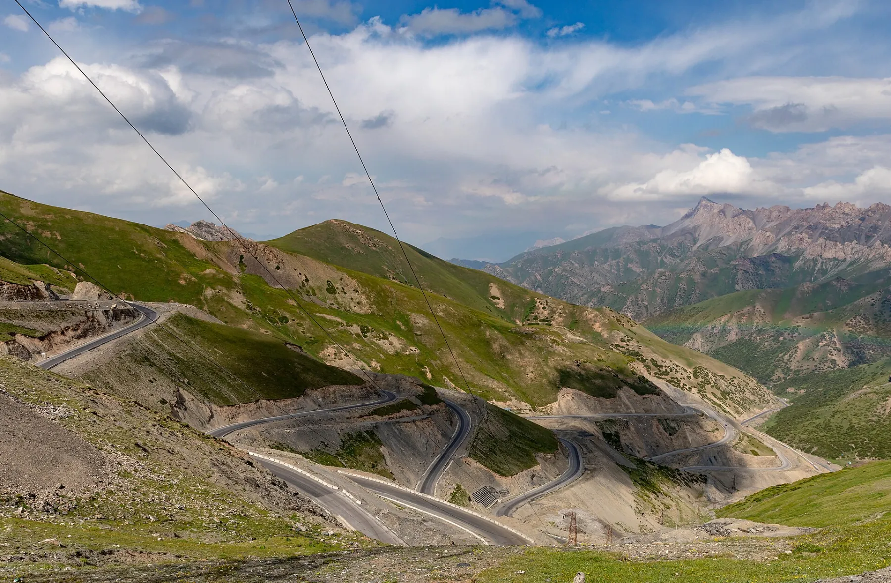 1/3. The road over Taldyk Pass Photo: Ninaras, Wikimedia Commons, CC BY 4.0; edited for this site.
 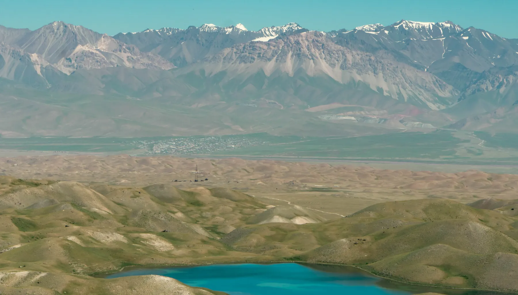 2/3. Sary-Mogol and the valley’s northern side Photo: Artur198686, Wikimedia Commons, CC BY-SA 4.0; edited for this site.
 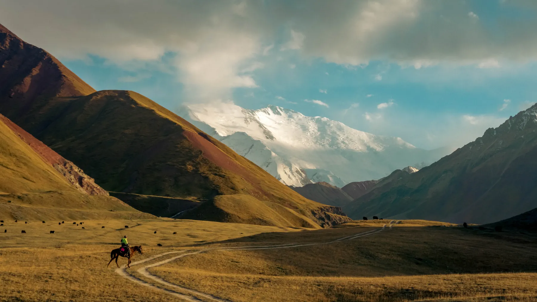 3/3. Pastures and local tracks Photo: Artur198686, Wikimedia Commons, CC BY-SA 4.0; edited for this site.
 Sary-Tash or Sary-Mogol: choosing a base
Sary-Tash stands at the junction for Irkeshtam, the Tajik border and the western Alay Valley. At roughly 3,200 metres, it works for a transit night, late arrival or early onward departure. Rooms and meals are limited, so confirm both accommodation and dinner in advance.
Sary-Mogol lies about 32 kilometres farther west and lower, at approximately 2,980 metres. It is the more practical visitor base: local drivers and horses for Tulpar-Kul are arranged here, and guesthouses serve trips before and after the lake. If the Trans-Alay Range is your main goal, saving a night by stopping only in Sary-Tash is rarely useful.
Keep the arrival day light with a short village or valley walk. The road climbs quickly from Osh, and a night at the lake will be about 500 metres higher again. Good fitness does not guarantee a comfortable reaction to that altitude gain.
How to reach Tulpar-Kul
Tulpar-Kul, written Tulpar-Köl in Kyrgyz, lies about 25 kilometres south of Sary-Mogol at roughly 3,500 metres. It is a system of lakes and small pools among moraine hills rather than one simple round lake. Reflections of Lenin Peak depend on wind, cloud and water level, so a guidebook image is not a promise of the same view at a particular hour.
The final approach follows unpaved tracks and branches near the river. A local transfer commonly takes about an hour. Conditions change after rain, and clearance matters more than the short distance suggests. Ask your camp to send its meeting point and current track: a generic Tulpar-Kul map pin does not identify the right access road.
Walking from Sary-Mogol is a proper approach with roughly 500 metres of ascent, not a stroll after a bus ride. It requires an early start, navigation, water and a confirmed bed. For a first visit, it is more practical to drive up locally, walk with a light pack and decide later whether a longer trek suits you.
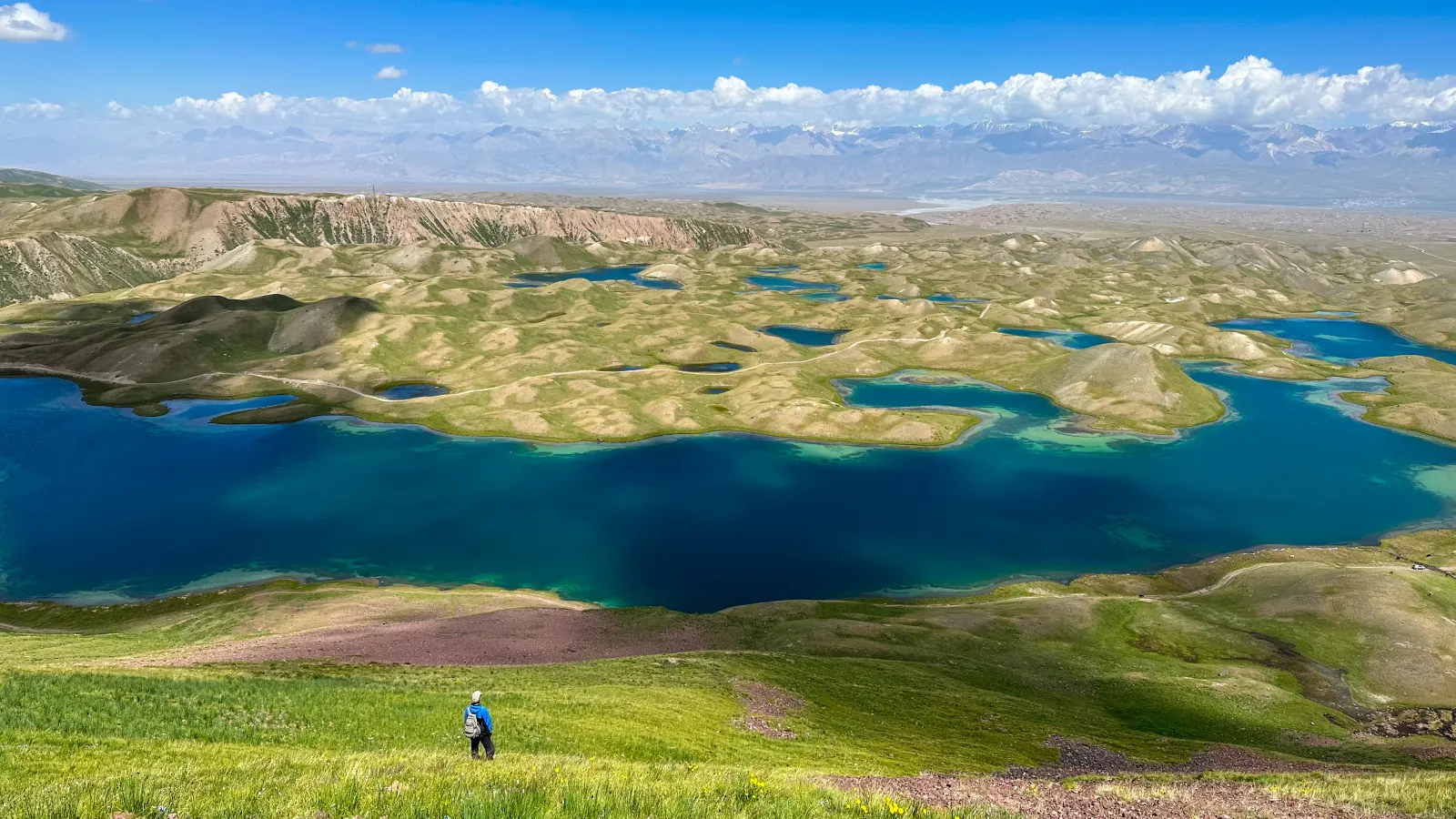 1/3. The Tulpar-Kul lake system Photo: Atantai Tazhibaev, Wikimedia Commons, CC BY-SA 4.0; edited for this site.
 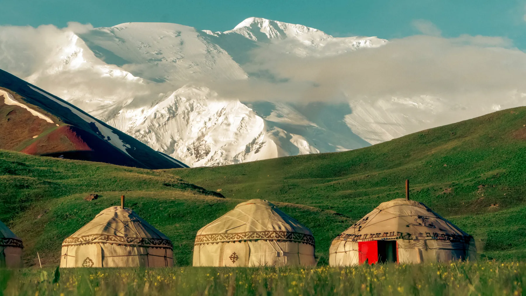 2/3. A seasonal yurt camp Photo: Artur198686, Wikimedia Commons, CC BY-SA 4.0; edited for this site.
 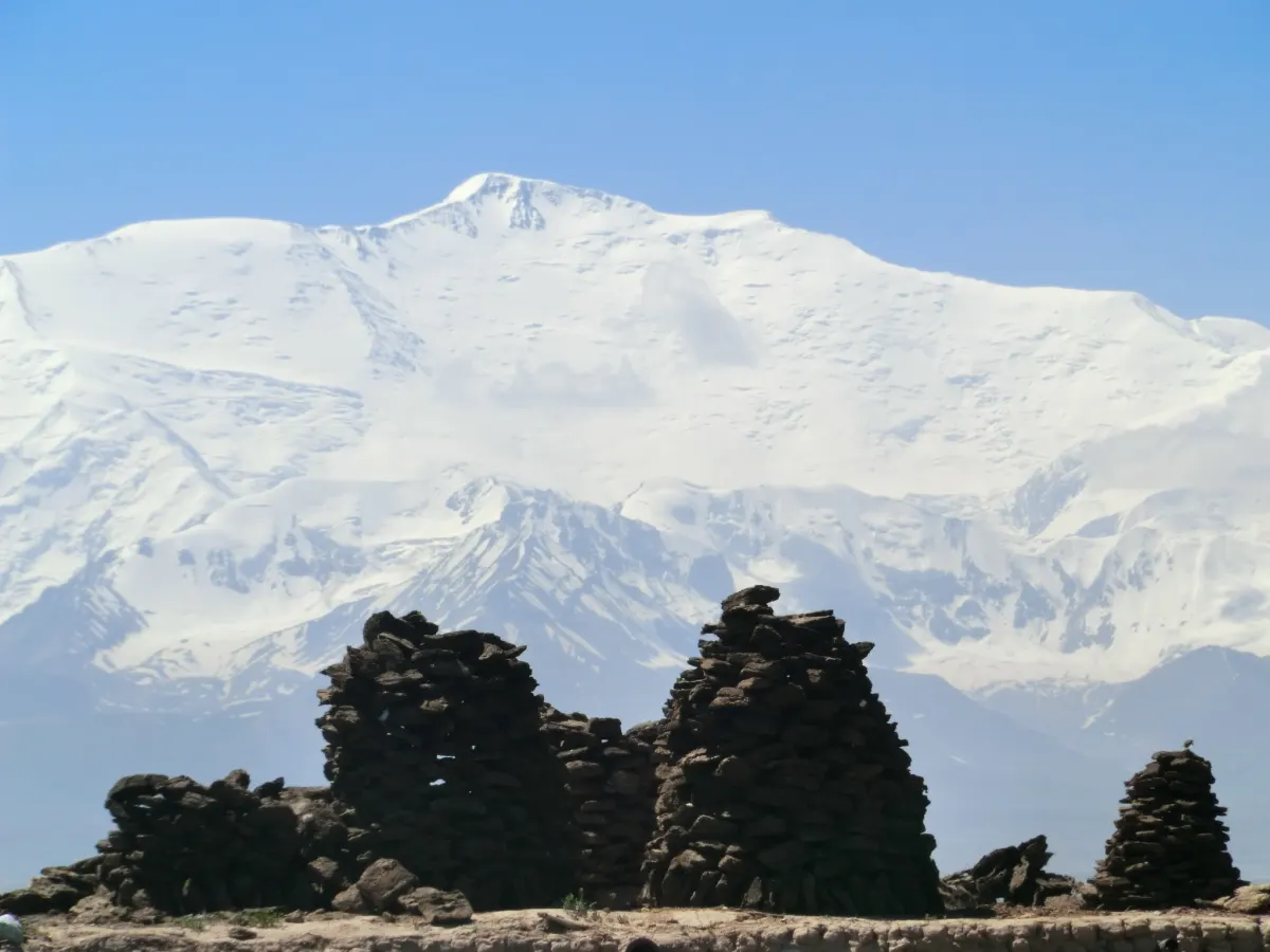 3/3. The Trans-Alay Range from Sary-Mogol Photo: Nihongarden, Wikimedia Commons, CC BY-SA 3.0; edited for this site.
 What to see and where to walk
The valley floor. Views do not begin at a ticket office or formal lookout. Safe pull-offs between Sary-Tash and Sary-Mogol reveal the channels of the Kyzyl-Suu, pasture and the northern face of the Trans-Alay Range. The useful plan is simple: do not rush the road and keep one clear morning.
The lake hills. At Tulpar-Kul, choose a short circuit around the nearest pools or a half-day walk over the ridges. Trails are not always marked, and similar hills quickly hide the camp. Save its coordinates, turn back when weather deteriorates and do not force a route across marshy shore for a reflection photograph.
A horse ride. Trips to the lake and across pasture can be arranged in Sary-Mogol. Before leaving, agree on duration, rider experience, a helmet, guide, luggage weight and finish point. The phrase “easy ride” says nothing about the number of hours in the saddle.
Achik-Tash and Travellers’ Pass. This is a separate extension into glacial terrain, greater altitude and the controlled border zone. Do not add it spontaneously to a lake walk. It needs a permit, early start, suitable acclimatisation and an agreed route; the Lenin Peak guide covers its requirements and risks.
Do you need a border permit?
No border permit is required for the main Alay Valley road or a night in Sary-Mogol. Farther south, the boundary depends on the exact track and destination. Public guides disagree in their wording about Tulpar-Kul, so do not rely on a general claim that every lake camp is automatically outside the permit area.
A firm planning boundary. Visit Kyrgyzstan explicitly lists Achik-Tash and Lenin Peak Base Camp among the Osh Region destinations requiring a border permit. Irkeshtam is listed separately.
Send the organiser your full list of places: Sary-Mogol, the specific Tulpar-Kul camp, Achik-Tash, Travellers’ Pass or another trail. Ask for a written answer identifying where the original permit is needed and who will obtain it. If the route reaches Achik-Tash or beyond, begin the process several weeks ahead and carry your passport.
Public transport and private cars
Bus or minibus. The published Osh bus station timetable checked on 27 August 2026 lists one Osh to Sary-Mogol departure at 14:00, as well as a service to Daroot-Korgon. Check the official table, then call or visit the ticket office the day before because the departure point, service and luggage rules can change.
Shared taxi. It may leave earlier and deliver you to a guesthouse, but usually only after filling. State Sary-Mogol clearly and agree on the per-seat fare, luggage and exact end point before boarding. Sary-Tash is a different junction and does not substitute for delivery to your accommodation.
Car with driver. This is convenient for three or four people and for safe stops on Taldyk. Agree separately on the lake transfer: a city vehicle and a local car for the dirt track may be two different services. Fix the payment, waiting time and return day before departure.
Your own car. The main road is paved, but pass weather changes quickly. Fuel in Osh or Gulcha, download an offline map and do not take the lake turn-off without a current road assessment. Tracks are harder to read after dark, and help is far away.
Accommodation, food, cash and signal
In Sary-Mogol, choose a guesthouse that can provide dinner and breakfast. Before paying, ask about private or shared rooms, heating, hot water, the toilet, bedding, an early breakfast and help with transfers. An exact pin is more useful than a name because similarly labelled houses are difficult to find after dark.
At Tulpar-Kul, seasonal yurt camps operate in summer. Facilities differ even between neighbours: a stove may run only in the evening, showers and toilets can be in a separate building, electricity may come from solar panels and mobile service depends on the precise spot. Confirm operating dates, beds per yurt, meals, charging and the access point.
Order dinner and breakfast when booking. For the day at the lake, bring water, a thermos, bread, nuts or another simple snack from Osh or Sary-Mogol. Do not drink from a stream without filtering and disinfecting it because herds and camps may stand upstream.
Carry enough cash for accommodation, food and the return transfer. A card terminal, ATM or mobile data connection is not guaranteed. Tell the host when you expect to arrive and save the phone number offline.
Season, weather and altitude
Spring
The valley opens before the lake, while pass snow and muddy dirt tracks remain possible.
- Do not assume yurt camps are operating.
- Check Taldyk and the lake approach separately.
Summer
The main season for Sary-Mogol, Tulpar-Kul, yurt camps and walking routes.
- July and August are more reliable for high trails.
- Thunderstorms, hail and cold nights remain possible.
Autumn
September can still bring clear days, but camps close and night temperatures fall quickly.
- Confirm the final operating date of accommodation.
- Allow for early snow on the pass.
Winter
Alay remains an inhabited valley, but the usual visitor plan to the lake no longer works.
- A winter-ready vehicle and local plan are needed.
- Do not transfer a summer trek onto snow without a fresh risk assessment.
An Osh forecast does not describe Taldyk or Tulpar-Kul. Check the pass, Sary-Mogol and the 3,500-metre zone separately. Our guide to the climate of Kyrgyzstan explains the broader seasonal and altitude differences.
A first night in Sary-Mogol is more useful than going straight to the lake. Headache, nausea, unusual weakness or poor coordination mean you should stop gaining altitude. Worsening symptoms call for descent and medical help, not waiting for the programme to continue.
Ready-made itineraries
First look at Alay
- Osh, Taldyk and Sary-Mogol.
- A night and easy morning in the village.
- Local car to Tulpar-Kul and a walk.
- Return to Osh on day three.
The lake without rushing
- A Sary-Mogol night to adapt.
- Transfer and a night in a yurt camp.
- Morning circuit over the lake hills.
- Time in reserve for weather and roads.
Valley plus one activity
- Two bases: Sary-Mogol and Tulpar-Kul.
- A horse ride or local day trek.
- Achik-Tash only with permit and plan.
- Return without a night drive.
Do not choose from Osh
- About 440 km return travel.
- Rapid altitude gain.
- Almost no time at the lake.
- One delay breaks the whole day.
What to check before departure
- Transport: confirmed bus or driver, departure point, luggage and the exact Sary-Mogol address.
- Road: Taldyk open, with no recent debris flow, snow closure or disruptive works.
- Accommodation: operating dates, heating, toilet, meals, electricity and the camp pin.
- Border zone: a written answer for every point south of Sary-Mogol and the original permit for Achik-Tash.
- Altitude: an easy first night, warm clothing, sun protection and a descent plan if symptoms begin.
- Reserve: cash, water, food, offline map, power bank, torch and an unallocated weather window.
A good Alay trip is not measured by the number of pins. Give the valley two chances for clear weather, choose one village base and one lake base, and add the glaciers only after checking documents and altitude.
Share on social media
If you found this guide useful, share it on social media. It takes a moment and helps more travellers discover the project. Thank you!
Anything to add?
Share your experience, leave a comment or suggest an improvement.