Contents:
Where the Tian Shan is
The Tian Shan is a vast Central Asian mountain system made up of many ranges. It extends from western China through Kyrgyzstan and Kazakhstan towards Uzbekistan. Mostly east-west ridges alternate with valleys, enclosed basins and high plateaux.
These mountains define Kyrgyzstan’s geography. They border the Chüy valley and Issyk-Kul, form the Naryn highlands and rise towards the country’s largest glaciers on the Chinese frontier. About 90% of Kyrgyzstan lies above 1,500 metres, although the mountains in the south-west belong to the separate Pamir-Alay system.
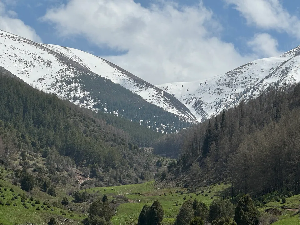 1/4. Northern Tian Shan near Bishkek Photo: Timjusup, Wikimedia Commons, CC BY-SA 4.0; edited for this site.
 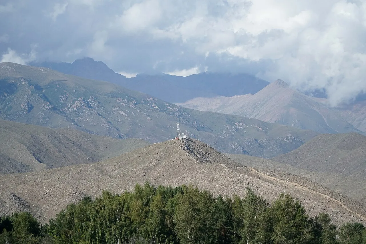 2/4. The range above Issyk-Kul Photo: Adam Harangozó, Wikimedia Commons, CC BY-SA 4.0; edited for this site.
 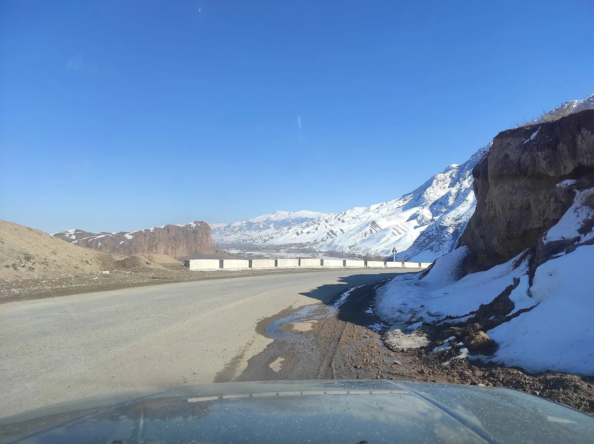 3/4. Inner Tian Shan Photo: Artelow, Wikimedia Commons, CC0 1.0; edited for this site.
 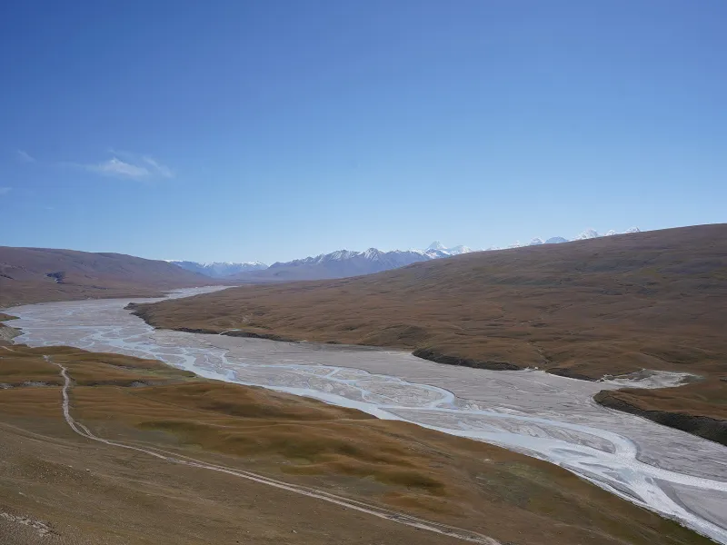 4/4. Central Tian Shan Photo: Nadine Hitz, Wikimedia Commons, CC BY-SA 4.0; edited for this site.
Northern
Bishkek, Chüy, Issyk-Kul
The easiest gorges to reach, established resorts and practical bases for a first mountain day.
Inner
Naryn, Song-Kul, At-Bashy
High basins, plateaux, summer pastures and long drives over mountain passes.
Central
Sary-Jaz, Enilchek
Major glaciers, the highest peaks and expedition country along the Chinese frontier.
Western
Talas, Chatkal, Sary-Chelek
Wetter slopes, fruit and nut forests, and the western ranges of the system.
The markers give a broad sense of direction. This is a trip-planning diagram, not a map of scientific boundaries: geographical classifications differ in how they name and divide the Tian Shan.
What the name Tian Shan means
The familiar name comes from Chinese and is usually rendered in English as “Celestial Mountains”. Both Tian Shan and Tianshan appear in English-language sources. The Kyrgyz name, Teñir-Too, is connected with teñir, the sky and an older idea of heavenly height.
Names on maps: one place may be labelled in Kyrgyz, Russian or international transliteration. Check coordinates, the neighbouring valley and the direction of approach instead of relying on a single spelling.
Four Tian Shan regions for travellers
There is no single boundary system accepted in every scientific field. For planning, four broad areas are useful because they also differ in access, scenery and difficulty.
Northern Tian Shan. The Kyrgyz Ala-Too rises immediately south of Bishkek. The Küngöy Ala-Too follows Issyk-Kul’s northern shore and the Terskey Ala-Too its southern shore. This is where you find easy-access routes in Ala-Archa, Chunkurchak and the valleys around Karakol.
Inner Tian Shan. Naryn Region has a different scale: broad treeless basins, high pastures, long passes and considerable distances between settlements. Typical reference points are Naryn, Song-Kul, At-Bashy and Tash Rabat.
Central Tian Shan. East of Issyk-Kul lie the Sary-Jaz valley, Enilchek Glacier, Khan Tengri and Victory Peak. This is Kyrgyzstan’s country of highest summits and largest glaciers. Even a road trip to the village of Enilchek requires a border-zone permit; glacier treks and climbs demand separate expedition logistics.
Western Tian Shan. The Talas, Chatkal and Fergana ranges receive more moisture than the interior. Forests, wild fruit trees and a rich sequence of altitude zones distinguish the region. The Western Tian Shan is a World Heritage property recognised for biodiversity and wild relatives of cultivated fruit species; Sary-Chelek is one of its clearest landmarks in Kyrgyzstan. The UNESCO listing explains its international importance.
Where the Tian Shan ends and the Pamir-Alay begins
Not every mountain in Kyrgyzstan is part of the Tian Shan. The Alay Valley, the Trans-Alay Range and Lenin Peak in the south belong to the Pamir-Alay. Travellers notice the distinction through the route rather than a line on the ground: the Alay is normally approached through Osh, while the northern and central Tian Shan use Bishkek, Naryn or Karakol as gateways.
This matters when you search for weather, maps and insurance. “A trip to the mountains of Kyrgyzstan” can describe a gentle walk outside the capital, a horse trek across the inner highlands or a high-altitude expedition in a different mountain system.
How the Tian Shan landscape changes
The Tian Shan is still rising through active tectonic processes. Sharp mountain forms, broad intermontane basins and rivers cutting across ranges therefore sit close together. A short drive can move from an arid valley to spruce forest, alpine meadow, scree and snow.
Altitude changes the landscape faster than distance. Orchards and steppe grasses grow at lower levels; juniper and Tian Shan spruce appear higher up; alpine meadows then give way to rock, snow and ice. Glaciers store water in the cold season and feed rivers during warmer months. As they retreat, they also alter the terrain and the risks around newly formed glacial lakes.
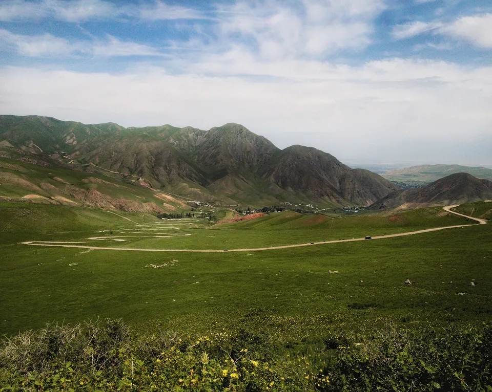 1/4. Rounded forms in the foothills Photo: Vilya Shoni, Wikimedia Commons, CC BY-SA 4.0; edited for this site.
 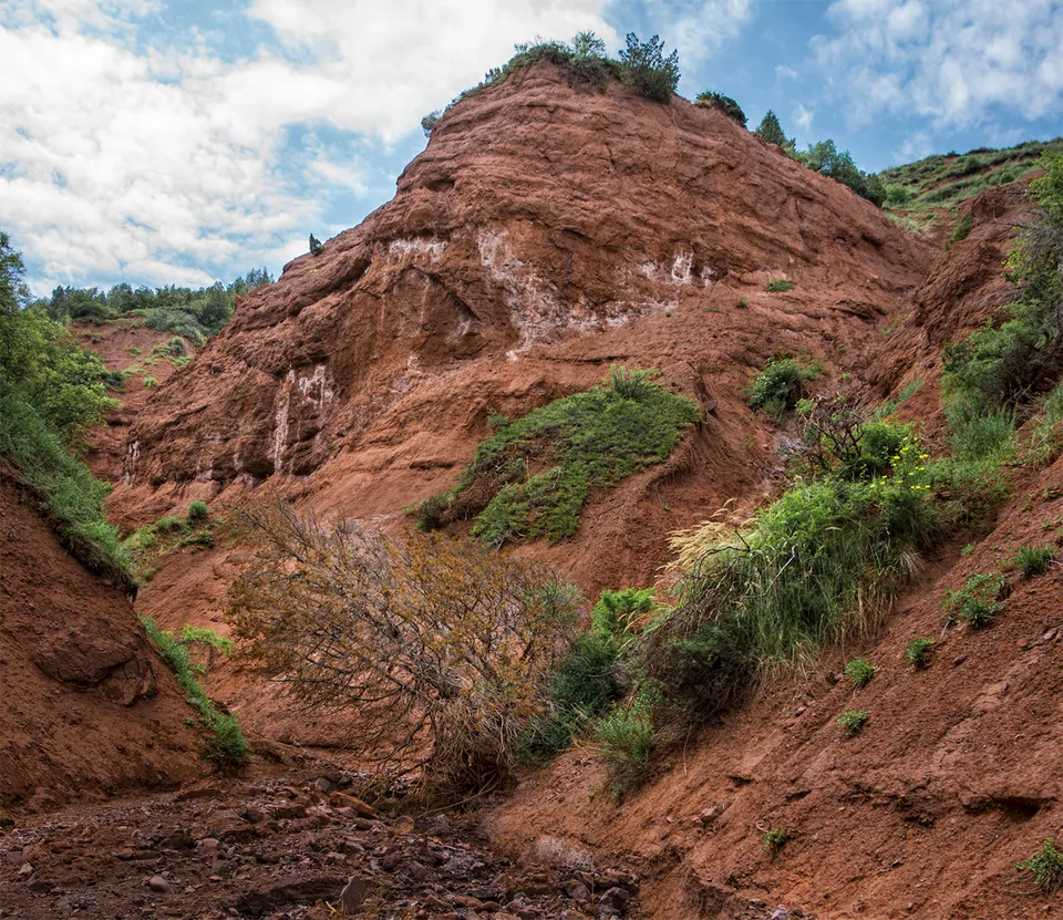 2/4. Exposed rock in a northern gorge Photo: Vilya Shoni, Wikimedia Commons, CC BY-SA 4.0; edited for this site.
 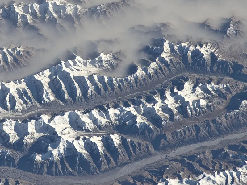 3/4. Valley and glaciers from orbit Photo: NASA Johnson Space Center, Wikimedia Commons, Public domain; edited for this site.
 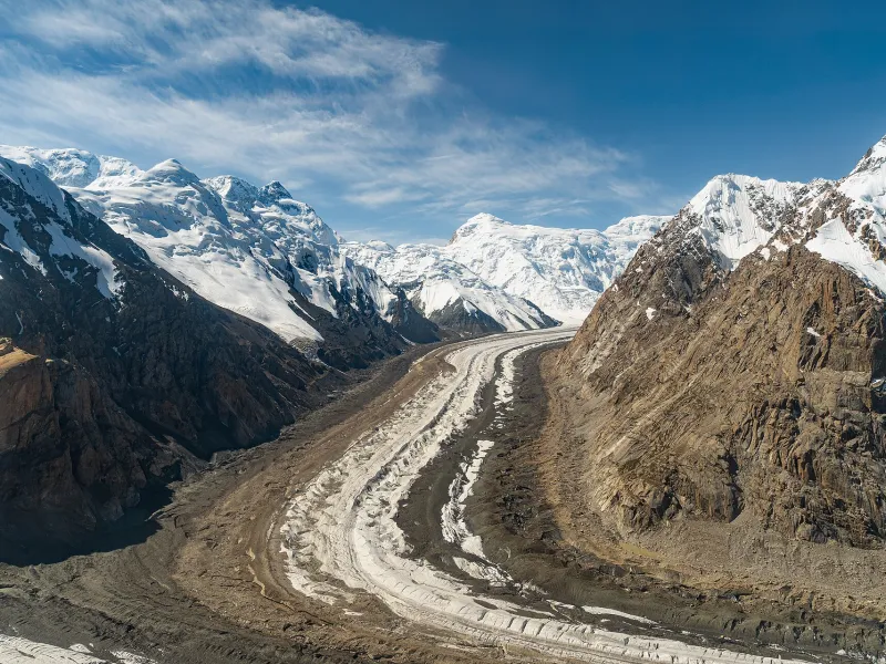 4/4. The glacial belt of the Central Tian Shan Photo: Maryliflower, Wikimedia Commons, CC BY-SA 4.0; edited for this site.
 Where to go in the Tian Shan for the first time
A Northern Tian Shan gorge
- Choose Ala-Archa or Chunkurchak.
- A practical first mountain walk without an overnight stay.
- Check the forecast for the high point, not only the city.
Lake and mountain valleys
- Use Karakol or a lakeside town as your base.
- Alternate drives and gorge walks with slower days by the water.
- Do not apply a lakeshore forecast to a high pass.
The Inner Tian Shan
- Combine Naryn, Song-Kul and At-Bashy.
- Allow time for unpaved roads and cold nights.
- Confirm accommodation and transport before leaving town.
Sary-Jaz and Enilchek
- Begin with permits, a driver and a communications plan.
- Do not confuse the drive to the village with a glacier trek.
- Altitude and glacier travel require specific experience and insurance.
When to visit the Tian Shan
There is no single season for the whole system. In May, lower gorges near Bishkek are already green while high passes in Naryn and the Central Tian Shan remain snowbound. July can be warm beside Issyk-Kul but still brings cold, wind and winter conditions on glaciers and at several thousand metres.
June to August opens the widest range of ordinary walking and driving routes. September often brings clear air and cold nights. Winter and spring work only for a defined objective such as a ski area, low gorge or journey backed by avalanche assessment. Our guide to Kyrgyzstan’s climate compares the regions in more detail.
A date on the calendar does not open a pass. Check a recent road report, the forecast for the highest point, rainfall over the previous days and the conditions for your return.
How to prepare for the mountains
Start by defining the activity: a walk, multi-day trek, horse ride, road trip or climb. Then check the altitude, ascent, road surface, communications, accommodation and turnaround point. Our active travel guide explains the main formats.
Download an offline map and save the coordinates of key points. Leave your route and next check-in time with someone. Carry water, spare food, sun and rain protection, an insulating layer, a torch, first-aid kit and charged power bank. Remote roads also call for a spare wheel and a driver familiar with current conditions.
Ask about permits well in advance for Sary-Jaz, Enilchek and other border zones. Your insurance must explicitly cover the altitude and activity, including evacuation where relevant. Call 112 in an emergency if you have a signal. Keep your distance from wildlife and carry out food waste and rubbish; our guide to Kyrgyzstan’s animals explains safe encounters.
Share on social media
If you found this guide useful, share it on social media. It takes a moment and helps more travellers discover the project. Thank you!
Anything to add?
Share your experience, leave a comment or suggest an improvement.