Why visit Andijan Reservoir?
On the Kyrgyz side, the reservoir is more often called Kempir-Abad; in Uzbekistan and on international maps, it is known as Andijan Reservoir. Come not for a beach, but to see how a large reservoir transforms the dry landscape of the Fergana Valley and connects water, borders, energy and agriculture across two countries.
The main view. Open sections of road reveal the reservoir's broad basin, indented shoreline and low, arid ridges. Water levels vary with the season and operating regime, so the shore can look quite different in photographs taken in different years.
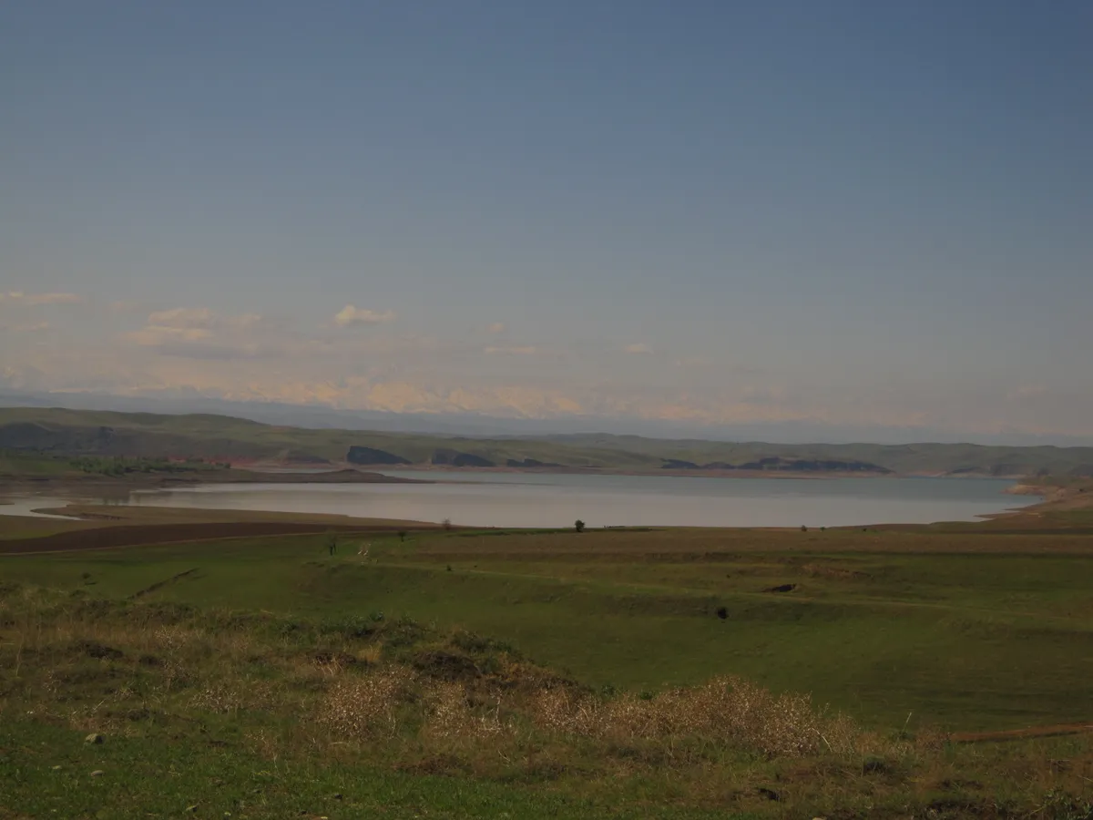 1/2. The reservoir's northern arm Photo: Peter in s, Wikimedia Commons, CC BY-SA 3.0; edited for this site.
 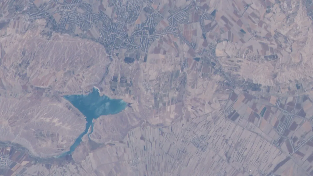 2/2. The reservoir in the Fergana Valley Photo: Earth Science and Remote Sensing Unit, Lyndon B. Johnson Space Center, Wikimedia Commons, Public domain; edited for this site.
 Engineering scale. The reservoir has a total capacity of about 1.9 cubic kilometres and covers roughly 4,400 hectares at its designed full level. It stores the flow of the Tar and Kara-Kulja rivers, which join to form the Kara-Darya, before releasing water into the Fergana Valley irrigation system.
An important restriction. The dam, water-intake structures, service roads and border infrastructure are not tourist attractions. Do not assume that tours of the hydropower station, unrestricted access to the water, boat trips or swimming are available without specific confirmation from your local host.
How to get to the reservoir
The point shown on this page lies near the north-eastern part of the reservoir. From Osh, the route heads through Uzgen District, but a navigation app may direct you towards a closed service road, a border area or the opposite shore. Choose a specific public viewpoint with a local driver rather than relying on a map pin alone.
Before setting out, ask your local host about road conditions and the current access regime. Follow all instructions from border guards and security staff, keep your passport with you and do not photograph checkpoints or technical structures without permission. A barrier, sign or instruction to turn back takes precedence over a route saved on your phone.
A well-maintained ordinary car is normally sufficient for the roads through the main settlements. Turning onto an unfamiliar dirt track will not necessarily shorten the journey: clay shores become soft after rain, and there are steep drops near the water. Park on firm ground, do not block local roads and allow enough time to return before dark.
Why does the reservoir have two names?
The historical name Kempir-Abad comes from the area on the Kyrgyz side. In Uzbekistan, it is called Andijan Reservoir after the region that receives water and electricity from the hydraulic complex. Both names refer to the same body of water on the Kara-Darya.
The modern reservoir was built during the Soviet period and entered service in 1983. Part of the valley was submerged when it filled, and the new hydraulic complex became one of the principal regulators of water for the Fergana Valley's irrigated land.
After the Soviet Union dissolved, the border and arrangements for using the reservoir remained under negotiation for many years. In 2022, Kyrgyzstan and Uzbekistan signed a treaty covering sections of the state border and a separate agreement on the joint management of Kempir-Abad Reservoir's water resources. An official statement by the President of Kyrgyzstan confirms the documents' ratification. Older descriptions that simply call the reservoir “disputed territory” therefore no longer reflect the current legal regime.
What to see and how to behave by the water
A panorama of the basin. Look for a broad view from a public road rather than descending to the water's edge. The relief appears softer in the morning, while the dry slopes gain contrast in the evening. A telephoto lens lets you photograph the shore and water without approaching the technical zone.
Seasonal changes. Exposed terraces show how far the reservoir level can vary. This is a working water reserve, so a familiar bay may dry out and a shore accessible yesterday may be submerged. Do not leave your vehicle on flat ground immediately beside the water.
The Kara-Darya and irrigation system. The significance of the site goes beyond a single dam. The reservoir receives water from mountain rivers, regulates the flow and supports agriculture in the densely populated valley downstream. That context is more useful than an invented tour inside the hydropower station.
Do not pass barriers, fly a drone without checking the rules or try to reach the dam along a service road. For swimming, fishing or boating, choose a place where the local authorities have clearly permitted the activity. Without such confirmation, limit your visit to a viewpoint.
Share on social media
If you found this guide useful, share it on social media. It takes a moment and helps more travellers discover the project. Thank you!
Anything to add?
Share your experience, leave a comment or suggest an improvement.