Contents:
How to organise a trip across Jalal-Abad Region
The region spans the hot lowlands of the Fergana Valley, the walnut-fruit forests of Arslanbob, the western foothills around Aksy, the Naryn valley and the high roads of Toguz-Toroo. Travelling between its outer edges takes a full day and remains sensitive to weather, roadworks and mountain passes.
Use four travel corridors: Manas and Arslanbob in the south; Kerben and Arkyt in the west; the northern highway through Tash-Kumyr, Kara-Kul and Toktogul; and Kazarman with Saimaluu-Tash as a separate expedition branch. With two or three days, choose one corridor. A broader circuit needs several bases and spare days.
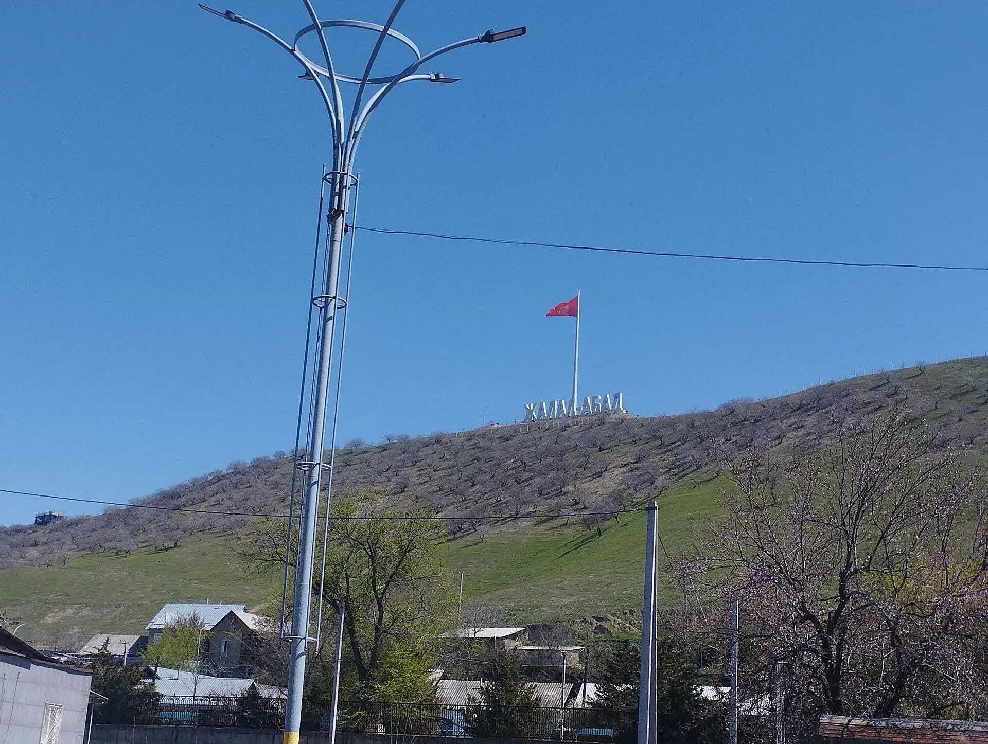 1/3. Manas, the main southern base Photo: Mirzoulugʻbek, Wikimedia Commons, CC0 1.0; edited for this site.
 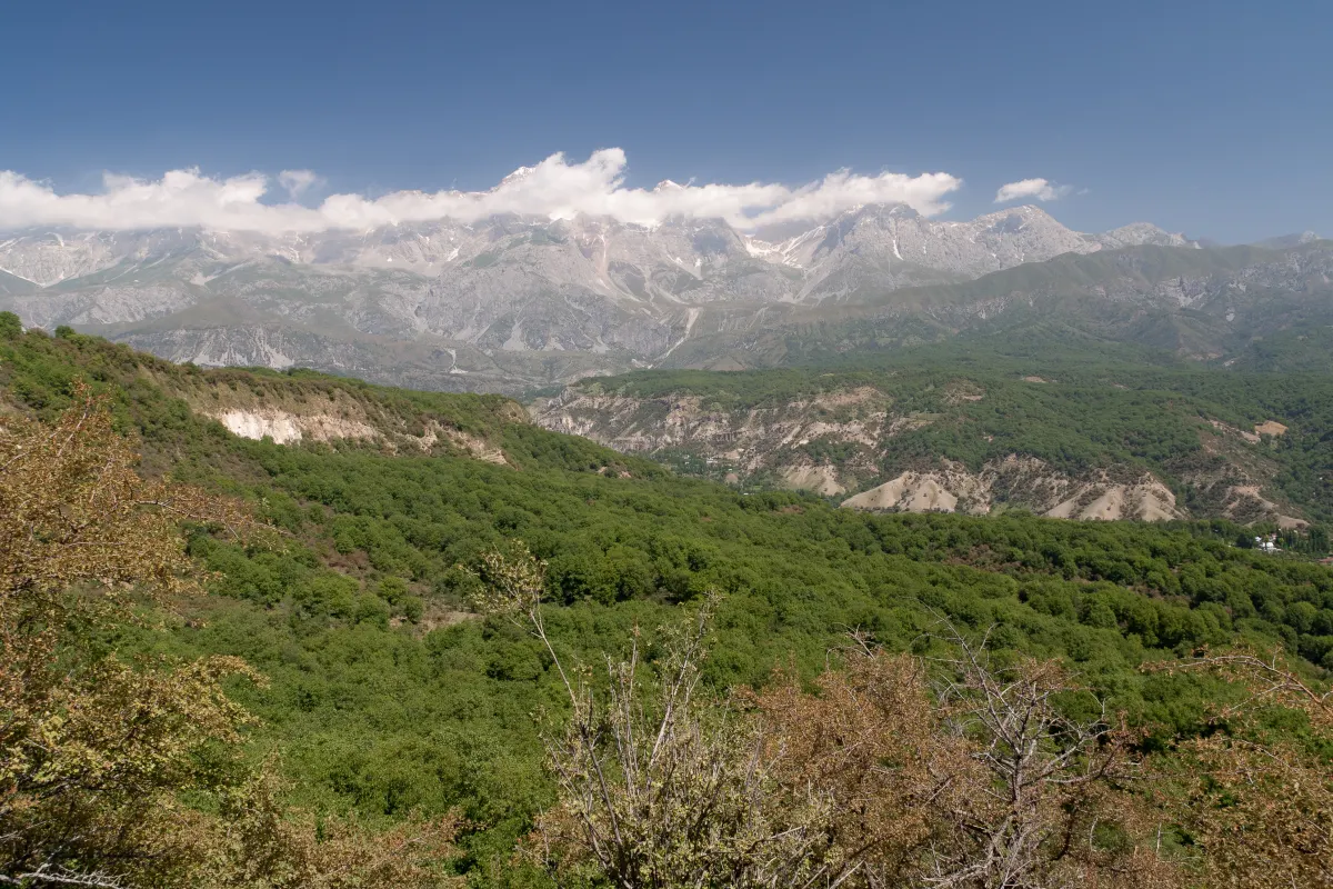 2/3. The forests of Arslanbob Photo: Ekrem Canli, Wikimedia Commons, CC BY-SA 3.0; edited for this site.
 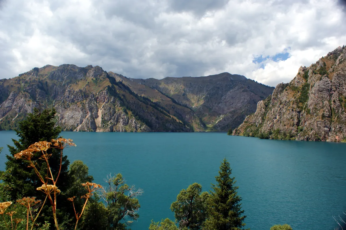 3/3. Sary-Chelek in the west of the region Photo: Kondephy, Wikimedia Commons, CC BY-SA 4.0; edited for this site.
 Manas and Jalal-Abad now refer to different administrative levels. The region retains the name Jalal-Abad Region, while its capital was officially renamed Manas in 2025. The former city name still appears in routes, signs and links.
The springs, Ayub-Too, city walk and accommodation are covered in our separate guide to Manas. This page answers a different question: which part of the region to choose, where a change of accommodation saves time and which roads cannot be treated as a short extension of a city day.
Where to set up your bases
Manas. The easiest base for a first night, practical errands, the Suzak direction and the start towards Arslanbob. Hotels, ATMs, cafés, drivers and intercity transport are easier to find here. Manas is already too far away for a useful base at Sary-Chelek or Toktogul.
Arslanbob. Stay overnight for an early forest walk, waterfalls, the village market and a calmer pace. There is a useful range of guesthouses, but confirm meals, hot water, parking and the meeting point with a guide before arrival.
Kerben or Arkyt. Kerben works for supplies, cash and a stopover in Aksy District. Arkyt is closer to the reserve and saves time in the morning, but has fewer rooms and services. For Sary-Chelek, book a named guesthouse rather than relying on a village label on the map.
Toktogul. A practical northern base on the Osh-Bishkek road. It gives easier access to reservoir viewpoints, the Chychkan valley and the onward road through Suusamyr. Kara-Kul and Tash-Kumyr can be deliberate transit stops if you want to see the Naryn valley without driving at night.
Kazarman. The base for Toguz-Toroo and Saimaluu-Tash, with its own transport plan, guide, accommodation and weather margin. It should not be treated as a universal stop between north and south.
Manas, Bazar-Korgon and Arslanbob
The southern part of the region has more frequent and straightforward links with Osh than with the western and northern districts. Manas is the transport hub, Bazar-Korgon is the working junction, and the branch to Arslanbob climbs towards the Fergana Range.
Arslanbob draws visitors to its walnut-fruit forests, large mountain village and walks to waterfalls. A day trip can work with an early start and a pre-arranged car, but an overnight stay provides a proper morning and enough time for the forest. Agree the distant waterfall route, trail conditions and return time with a local guide.
The village centre is useful for the market, simple meals and a view of everyday life. Forest tracks divide quickly and mobile coverage varies with the terrain. Download a map, save the accommodation address and do not expect one waterfall name to identify the correct path.
Buy walnuts, dried fruit and household produce directly from a seller after agreeing the price and quantity. Ask before photographing a person or courtyard. Families may use both orchards and forest plots, so a visible track does not grant access in every direction.
Kerben, Arkyt and the west
The western route follows Tash-Kumyr, Kerben and Arkyt towards Sary-Chelek. The journey is broader than a single lake: the landscape changes from the Naryn valley to the dry hills, orchards and Chatkal foothills of Aksy.
Kerben is the stronger stop for a market, fuel, cash and a night indoors. In Arkyt, a pre-ordered dinner, an early transfer and the reserve rules matter more. Confirm entry, fees, the drivable section and access to your intended trail before arrival. Detailed lake logistics stay in the dedicated Sary-Chelek guide so that this regional page retains its planning role.
Safed-Bulan and the Shah-Fazil mausoleum lie in the Ala-Buka direction. Give them a dedicated cultural day and behave respectfully in an active religious setting. Modest clothing, permission for indoor photography and a local interpreter are more useful than a rushed stop between two long drives.
Chatkal District lies farther west behind mountain roads. Add it only with a named base, a suitable vehicle and current road information. It is not a spontaneous extension of a day at Sary-Chelek.
Tash-Kumyr, Kara-Kul and Toktogul
The northern axis follows the Naryn through Tash-Kumyr and Kara-Kul towards Toktogul. The river, narrow valleys, dams, transmission lines and the widening reservoir basin define this part of the region.
Use the Naryn towns as meaningful stops rather than a checklist. Tash-Kumyr shows how a town is squeezed between river and slopes. Kara-Kul lies below the Toktogul dam, while open views over the Toktogul Reservoir appear farther north along the highway.
Hydropower facilities remain operating industrial sites. View the valley from public roads and authorised areas, keep away from gates for photographs and do not fly a drone near dams, substations or transmission infrastructure.
The full route between Osh and Bishkek has its own road guide. On a regional trip, choose a daylight section, allow time for stops and avoid setting off from Arslanbob for Bishkek after a long walk.
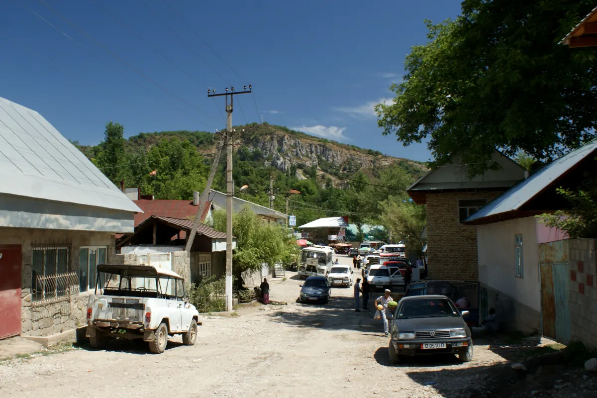 1/5. Everyday life in Arslanbob Photo: Kondephy, Wikimedia Commons, CC BY-SA 4.0; edited for this site.
 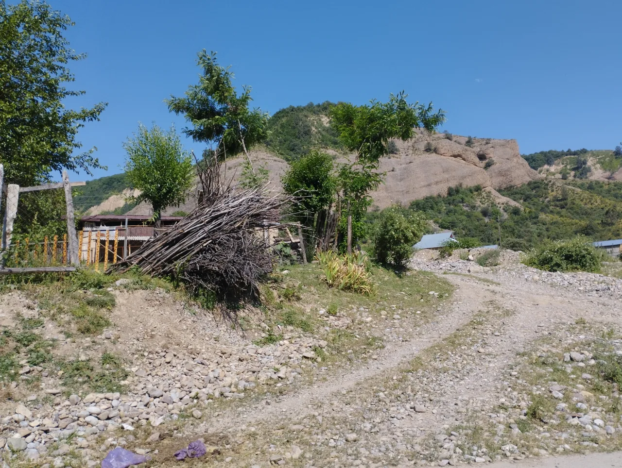 2/5. A rural landscape in Aksy Photo: Mirzoulugʻbek, Wikimedia Commons, CC0 1.0; edited for this site.
 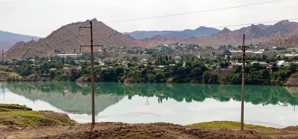 3/5. The road corridor along the Naryn Photo: Ninara, Wikimedia Commons, CC BY 2.0; edited for this site.
 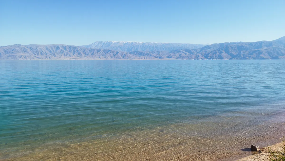 4/5. The reservoir north of Kara-Kul Photo: Arthur Dolchenko, Wikimedia Commons, CC BY-SA 4.0; edited for this site.
 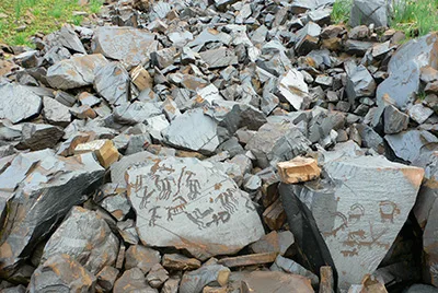 5/5. The high mountain complex of Saimaluu-Tash Photo: Sraosha 9, Wikimedia Commons, public domain; edited for this site.
 Kazarman, Toguz-Toroo and Saimaluu-Tash
Kazarman sits in the isolated Toguz-Toroo valley. Its approach roads cross high passes and sections of the unfinished North-South Alternative Road. Travel time depends on the season and current works, so a navigation app cannot replace a same-day road check.
Saimaluu-Tash needs a dedicated plan through Kazarman. A vehicle reaches only the agreed trailhead; the remaining approach is on foot or horseback. Access has a short season, the weather changes quickly and the return takes far longer than a conventional museum visit.
The history, UNESCO Tentative List status and responsible viewing rules are covered in our guide to the petroglyphs of Kyrgyzstan. The regional planning decision is simple: Saimaluu-Tash takes several days and cannot be added to a transit day through Toktogul.
Agree return transport, horses or the walking format, accommodation, water, warm equipment and a spare day with the organiser. If a pass, thunderstorm or fresh snow closes the route, postponing the journey is safer than trying to preserve a fixed timetable.
Getting there and travelling around
Osh is the convenient gateway to the southern part before continuing to Manas. Many travellers approach Toktogul and the northern corridor from Bishkek. The west and Kazarman need separate calculations because a straight line on the map says nothing about the last road section or time on high passes.
Buses, minibuses and shared taxis connect Manas with Osh, Bazar-Korgon, Kochkor-Ata, Tash-Kumyr, Kara-Kul, Toktogul, Kerben and other centres. Routes and departure times change, so start with the official bus station timetable and then reconfirm the service and boarding point at the ticket office.
For Arslanbob, Arkyt, Chatkal and Saimaluu-Tash, arrange a car or accommodation transfer in advance. State the final destination, waiting time, luggage, unpaved section and return journey in writing. A district name without a village or guesthouse is too vague for a reliable quote.
Roadworks continued on the Tash-Kumyr-Kerben-Ala-Buka corridor in 2026. The Ministry of Transport described the paving of one section as being in its final stage, so check the current western road update before departure. Our North-South Alternative Road guide explains the separate construction corridor through Kazarman.
Where to stay and what to eat
Manas has the widest choice of hotels, cafés, markets, pharmacies and ATMs. It works well for a late arrival and trip preparation. If your car leaves early, buy water and withdraw cash the evening before.
Arslanbob guesthouses often prepare breakfast and dinner by arrangement. Confirm meal times, a packed snack and bathroom facilities. The market is useful for seasonal fruit, walnuts, bread and simple prepared food, but do not postpone supplies until late evening.
Kerben and Arkyt serve different needs: the district centre is better for supplies, while the reserve village saves time in the morning. In Arkyt, book dinner as well as a bed. Do not rely on a 24-hour shop or card payment on the Sary-Chelek route.
Toktogul offers more road accommodation, cafés and supplies before the northern highway. In Kazarman, both food and accommodation belong to the expedition arrangement. Write down the address, host's name and phone number because coverage may disappear before the final turn.
When to go
Spring
The lowlands turn green before the mountains, making Manas and Arslanbob rewarding early in the year.
- Forest and village roads become muddy after rain.
- High passes and Saimaluu-Tash do not yet fit a normal trip plan.
Summer
The main season for Sary-Chelek, mountain walks and distant districts.
- The Fergana Valley is hot, so start early.
- Allow for thunderstorms, heavy rain and cold evenings in the mountains.
Autumn
Forests and orchards change colour while daytime heat eases in the lowlands.
- Arrange any participation in the walnut harvest with hosts or a guide.
- Late in the season, reconfirm accommodation and high mountain access.
Winter
Urban and transit journeys remain possible, but high branches need a large safety margin.
- Daylight is short and passes depend on snow and avalanche conditions.
- Do not build a winter itinerary around Saimaluu-Tash or an incidental dirt road.
Ready-made itineraries
Manas and Arslanbob
- First night and a short walk in Manas.
- Transfer to Arslanbob for the forest and village.
- Stay in Arslanbob or arrange the return in advance.
The west and Sary-Chelek
- Daytime drive through Tash-Kumyr and Kerben.
- Night in Arkyt or another confirmed base.
- A full day at Sary-Chelek plus road margin.
The Naryn and Toktogul
- Tash-Kumyr and the Naryn valley.
- Kara-Kul and northern reservoir viewpoints.
- Night in Toktogul before continuing.
Several parts of the region
- Manas and Arslanbob as one southern block.
- A separate overnight transfer towards Sary-Chelek.
- Return to the Naryn corridor without night drives.
Kazarman and Saimaluu-Tash
- Dedicated transport through Toguz-Toroo.
- Guide, camp and walking or horse approach.
- Spare day for weather and passes.
What to check before departure
- Choose one part of the region and the correct base for it.
- Reconfirm the road, departure time and final transfer point on the morning of a long journey.
- Book accommodation and meals in Arslanbob, Arkyt or Kazarman.
- Withdraw cash, fill the tank and download an offline map before leaving the main highway.
- Check access rules and a local guide for the reserve, mountain trails or Saimaluu-Tash.
- Carry water, sun protection, closed footwear and a warm layer even in summer.
- Reserve daylight for the last section and keep a backup plan for roadworks, rain or a closed pass.
Jalal-Abad Region rewards changing bases. Continue from its southern section into Osh Region, follow Toktogul towards Chuy Region, or compare all directions in our guide to the regions of Kyrgyzstan.
Share on social media
If you found this guide useful, share it on social media. It takes a moment and helps more travellers discover the project. Thank you!
Anything to add?
Share your experience, leave a comment or suggest an improvement.