Contents:
What “Silk Road” means in Kyrgyzstan
The Silk Roads formed a shifting network of land and sea routes between East Asia, Central Asia, the Middle East and Europe. Traders, envoys, pilgrims and craftspeople chose among different valleys and mountain passes as seasons, conflict, taxes and security changed. For a traveller today, the evidence lies in cities, caravan stops and landscapes rather than the trace of one continuous road.
The name “Silk Road” appeared only in the nineteenth century and is associated with the German geographer Ferdinand von Richthofen. In Kyrgyz, Жибек жолу, usually romanised as Jibek Jolu, means “Silk Road”; Улуу Жибек жолу means “Great Silk Road”. Both are modern collective names for a historical network whose branches shifted over time.
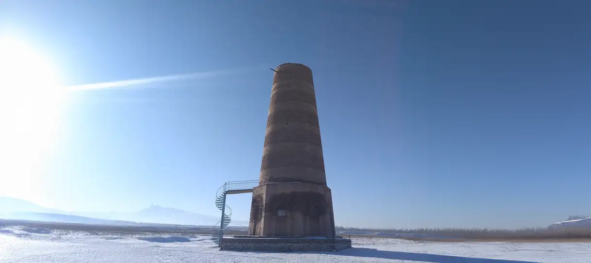 1/3. Burana and Balasagun in the Chüy Valley
 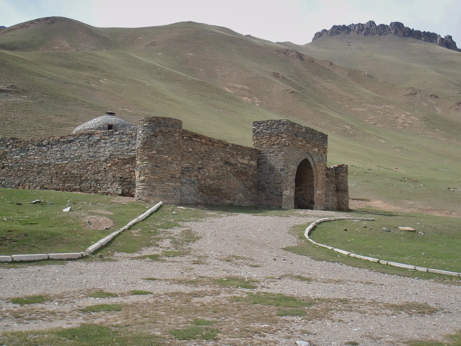 2/3. The high-altitude caravanserai at Tash Rabat Photo: Raki_Man, Wikimedia Commons, CC BY 3.0; edited for this site.
 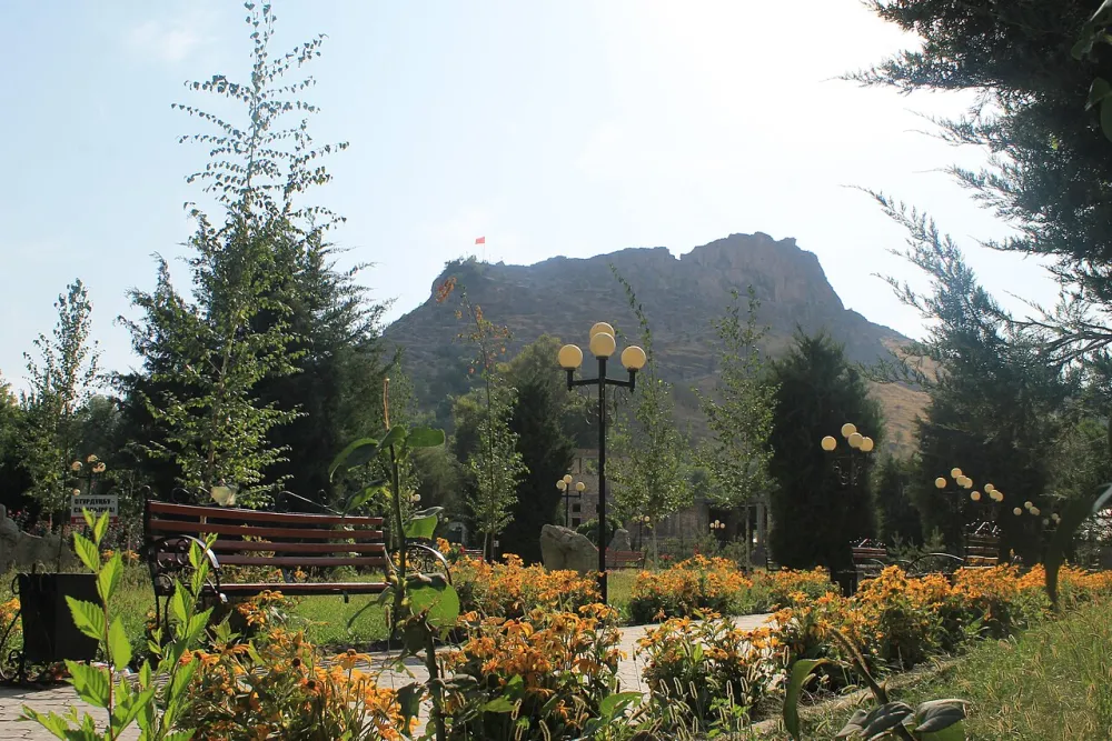 3/3. Sulaiman-Too in the Fergana Valley Photo: Erkinorozov, Wikimedia Commons, CC BY-SA 4.0; edited for this site.
 Why use the plural? Historians and UNESCO often write about the Silk Roads because branches split, rejoined and changed. The familiar singular name refers to the same network.
How the network of routes worked
Few caravans crossed the whole distance from China to the Mediterranean. Goods moved in stages: consignments were sold in cities, loaded onto different animals and passed to merchants who knew the next section. The cities of the Chüy and Fergana valleys mattered as places to rest, trade, produce goods and choose another direction.
Silk supplied the memorable name, but the routes also carried other textiles, horses, metals, glass, ceramics and spices. Religions, artistic forms, technologies and languages travelled with them. Archaeology in the Chüy Valley has revealed Buddhist, Christian, Zoroastrian and Islamic remains dating from different phases of the cities’ histories.
The Chang'an-Tianshan Corridor inscribed by UNESCO took shape between the second century BCE and the first century CE, flourished particularly from the sixth to the fourteenth centuries and remained a major route until the sixteenth century. These dates describe one vast corridor. They do not set a single beginning or end for exchange across the whole of Eurasia.
The Chüy Valley: three medieval cities near Bishkek
The transnational UNESCO property inscribed in 2014 has 33 component sites: 22 in China, 8 in Kazakhstan and 3 in Kyrgyzstan. All three Kyrgyz components lie in the Chüy Valley: Suyab at Ak-Beshim, Balasagun at Burana and Nevaket at Krasnaya Rechka. Together, they are Kyrgyzstan’s three component sites in the transnational World Heritage property.
Ak-Beshim and Krasnaya Rechka need some preparation. The shape of the settlement, the lines of the ramparts and the archaeological context matter more than intact buildings. Ak-Beshim has yielded evidence of Buddhist temples and Christian structures, while archaeologists at Krasnaya Rechka have found monuments linked to several religious traditions. The finds show how religiously diverse these cities were at different times.
Burana and ancient Balasagun provide the most accessible introduction. The surviving minaret, about 24 metres high, is visible from a distance; a small museum and a lapidary of stone figures stand nearby. Walk around the grounds before approaching the tower to grasp the scale: the modern Burana complex occupies only part of medieval Balasagun.
Allow 1 day from Bishkek for this trip. Make Burana the main stop. Visit Ak-Beshim and Krasnaya Rechka after learning their archaeological context, ideally with someone who knows the approaches and can read the landscape. A map pin alone does not guarantee an easy approach or visitor facilities.
The Inner Tien Shan: Naryn, Koshoy-Korgon and Tash Rabat
The Inner Tien Shan has a different geography of travel, shaped by broad valleys, pasture and passages towards Kashgar. Naryn makes a practical base. From there, the route runs through At-Bashy, the fortified site of Koshoy-Korgon and the Kara-Koyun Valley.
Tash Rabat stands at about 3,200 metres. The medieval stone complex served travellers on the route and is generally described as a caravanserai, but its date remains disputed. Some official accounts place it in the eleventh or twelfth century, while others date it to the fifteenth. The idea that it began as a monastery remains a hypothesis rather than a settled origin story.
Tash Rabat and Koshoy-Korgon are not components of the 2014 World Heritage property. They appear in a broader Kyrgyz proposal on UNESCO's Tentative List. Their historical importance is clear, but “UNESCO” here refers to a different process that has not resulted in World Heritage inscription.
Give the Inner Tien Shan 2–3 days rather than treating it as a quick excursion from Bishkek. Road conditions and camp availability change with the season, and access to Tash Rabat can also change. Check the separate guide before arranging transport.
The Fergana Valley: Osh, Sulaiman-Too and Uzgen
Osh grew at the entrance to important valleys and mountain routes. Use the city as a base: explore Sulaiman-Too first, then set aside a separate day for Uzgen. The sacred mountain has served as a landmark and place of pilgrimage for centuries, but its UNESCO status is separate. It entered the World Heritage List in 2009, not as part of the 2014 Silk Roads property.
Uzgen was a major urban and political centre under the Karakhanids. Its surviving ensemble of a minaret and three mausoleums stands beside the modern market and residential streets. The medieval centre remains part of an inhabited valley rather than an isolated historical display.
Uzgen joined other sites in Kyrgyzstan, Kazakhstan, Tajikistan and Uzbekistan in the 2025 nomination of the Fergana-Syrdarya Corridor. In final Decision 48 COM 8B.21, the UNESCO Committee deferred its examination in 2026 so that the States Parties could substantially revise the case and selection of component sites. Uzgen therefore remains outside the World Heritage List.
Allow 2 days for the southern route with Osh as your base: one for the city and Sulaiman-Too, then one for Uzgen. The modern highway does not prove the exact route of the medieval road. Compare two different kinds of place: a sacred mountain and a Karakhanid city.
How to build a modern Silk Roads itinerary
Chüy Valley
- Use Bishkek as your base.
- Make Burana and Balasagun the main stop.
- Prepare the archaeological context before adding Ak-Beshim and Krasnaya Rechka.
Inner Tien Shan
- Stay in Naryn or near At-Bashy.
- Stop at Koshoy-Korgon on the way.
- Visit Tash Rabat only after confirming access.
Osh and the Fergana Valley
- Visit Osh and Sulaiman-Too on the first day.
- Make a separate trip to Uzgen.
- Return to the same base without a long mountain transfer.
All three regions
- Use Bishkek for the Chüy Valley.
- Use Naryn for the Inner Tien Shan.
- Use Osh for the southern route.
You can combine all three regions in one journey, but they do not form a ready-made linear route. Bishkek, Naryn and Osh are far apart, and mountain-road conditions change. Compare flights with overland options in the main guide to transport in Kyrgyzstan. Do not schedule the longest transfer immediately before an international departure.
If time is limited, choose the region that best matches your main interest. The Chüy Valley gives the clearest account of a medieval city through archaeology. The Naryn section adds the scale of a mountain road and a caravanserai. Osh and Uzgen show the Fergana Valley as a lived-in urban setting where historical monuments remain part of the modern city.
How to read the historical sites along the way
Ask three separate questions before each visit: what archaeology has established, what formal status the place holds and what is accessible now. The answers often differ. A site can matter historically without World Heritage status, while an inscribed site can temporarily close for work.
At an ancient settlement, look for the shape of the ground, the direction of the ramparts, the position of water and the view across the valley. At a caravanserai, notice the entrance, wall thickness, interior light and relationship to the route. In a city, compare the medieval ensemble with the market and residential streets around it. These details turn the Silk Roads from an abstract arrow on a map into a network of specific places.
Save offline maps, check the current access information in the guide for each site and leave pottery and stone fragments where they are. A slow reading of one valley offers more than a long checklist of stops without context.
Share on social media
If you found this guide useful, share it on social media. It takes a moment and helps more travellers discover the project. Thank you!
Anything to add?
Share your experience, leave a comment or suggest an improvement.