Contents:
Distance, ascent and how much time to allow
Ala-Archa's official map gives a one-way distance of 5.7 km from Alplager to the hut. The return hike is therefore about 11.4 km. Elevation gain varies with the exact starting point and recorded track, but is roughly 1,100-1,200 m. The hut stands at 3,380 m.
Allow 4-6 hours for the ascent and 3-4 hours for the descent. With stops, this becomes an 8-11 hour mountain day rather than a quick extension beyond Ak-Sai Waterfall. The park's own map classifies the trail as hard.
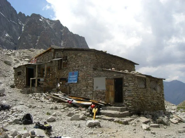 1/3. Ratsek Hut Photo: Andrew Litzenberger / All015, Wikimedia Commons, Public domain; edited for this site.
 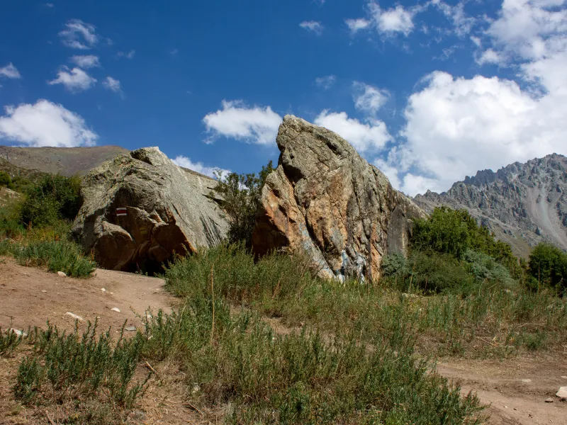 2/3. Broken Heart rock Photo: ElenaLitera, Wikimedia Commons, CC BY-SA 4.0; edited for this site.
 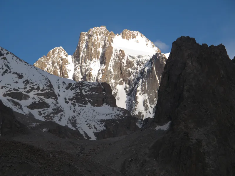 3/3. Korona Peak from the hut Photo: Tadeáš Gregor, Wikimedia Commons, CC BY-SA 3.0; edited for this site.
 The trail from Alplager, section by section
From the upper park area, follow the Ak-Sai route. Broken Heart rock marks the point where the easy approach turns into a sustained climb. The path continues across Tepshi plateau to Ak-Sai Waterfall. Entry and transport arrangements are covered in our broader guide to Ala-Archa.
The hardest section begins beyond the waterfall. The path climbs steeply over stony ground before reaching the moraine and camp. The distance can be deceptive: thinner air and a relentless gradient slow the group, while weather at the hut changes before it does in the valley.
The name. The hut and camp bear the name of Vladimir Ratsek, one of the region's mountaineering pioneers.
Download an offline map before setting out and check it at junctions. Fog, fresh snow and other people's footprints do not make the wrong line safe.
Day hike or overnight stay
In one day. This is a realistic plan for a fit hiker who has already completed routes with comparable elevation gain, starts very early and has return transport arranged. Decide on a turnaround time before leaving and respect it regardless of how close the hut appears.
With an overnight stay. Sleeping at the hut removes the race against daylight and gives you a calmer descent next morning. It does not make the climb easier: you will sleep at 3,380 m, where nights are cold and altitude illness is possible. If you have only just arrived in Bishkek, do not make the hut your first test at altitude.
Do not climb without a plan. Confirm a bed or permission to pitch a tent, check the forecast for the upper gorge and arrange your journey out of the park.
The hut, booking and services
As checked on 19 August 2026, the operator listed 35 places, shared rooms, one private room, solar power, meals, sleeping-bag hire and tent space. Availability, services and prices can change, so use the hut booking page before you set out.
“Open year-round” describes the accommodation, not a guarantee that the trail is safe every day. Snow, ice and avalanche conditions can turn a hike into a mountaineering objective. Carry the essentials from the valley instead of assuming that every forgotten item can be hired or bought at the hut.
When to go and how to judge the weather
Summer and early autumn, when the trail is free of snow, offer the most approachable conditions for an independent trek. Even in July, mornings at the hut can be cold, and cloud, rain, hail or thunderstorms may develop later in the day. A forecast for central Bishkek does not describe conditions at 3,380 m.
Snow lingers on the upper slope in spring and returns earlier than it does in the valley. Winter and continuous snow cover demand snow-travel skills, avalanche assessment and suitable equipment. Without that experience, choose a lower route in Ala-Archa.
Equipment, altitude and the decision to turn back
Bring hiking boots, an insulating layer, waterproof shell, hat and gloves, sun protection, food, a headtorch, first-aid kit, power bank and offline map. Carry at least two litres of water per person plus a reliable treatment method if you plan to refill. Our mountain activity guide has a broader preparation list.
Do not drink untreated stream water and do not rely on mobile reception. Leave your route and a check-in time with someone you trust; call 112 in an emergency. More practical precautions are covered in our Kyrgyzstan safety guide.
Do not climb higher if a headache comes with nausea, dizziness or marked fatigue. Descend if symptoms worsen while you remain at the same elevation. Confusion or loss of coordination requires immediate descent and help. Weather, injury or the group's pace are equally valid reasons to turn around without trying to force the objective.
What begins above the hut
Ratsek is a base for approaches to Ak-Sai Glacier and mountaineering peaks. Those routes are not part of the hike described here. Ice, hidden crevasses, rockfall and steep ground require a separate plan, technical equipment and the skills to use it.
Other well-known peaks in the park use separate approaches. The classic route to Komsomolets Peak goes through Tarasik and Fioletovy Pass, while Agitatorov Peak rises above Adygene Gorge. Neither is an extension of the Ratsek trail, so confirm the actual starting point with the leader of that specific ascent.
Even the relatively popular Uchitel Peak remains a mountain ascent, while Korona and the surrounding walls are technical climbing terrain. An ordinary hike ends at the hut, leaving enough energy and daylight for a safe descent.
Share on social media
If you found this guide useful, share it on social media. It takes a moment and helps more travellers discover the project. Thank you!
Anything to add?
Share your experience, leave a comment or suggest an improvement.