Contents:
Why visit Mailuu-Suu
Mailuu-Suu fills a narrow valley of the river of the same name at the northern edge of the Fergana Valley. This city of regional significance grew around a uranium combine and later gained a major electric lamp factory. That history is still visible in its street plan, workers’ housing, factory buildings and the abrupt meeting of urban blocks and mountain slopes.
Half a day is enough for most visitors. The essential first stop is the Museum of the History of Mailuu-Suu and the Uranium Heritage of Kyrgyzstan. You can then walk through the centre and see the valley from an accessible public road. Mines, adits, tailings sites and waste dumps are outside a safe self-guided city route.
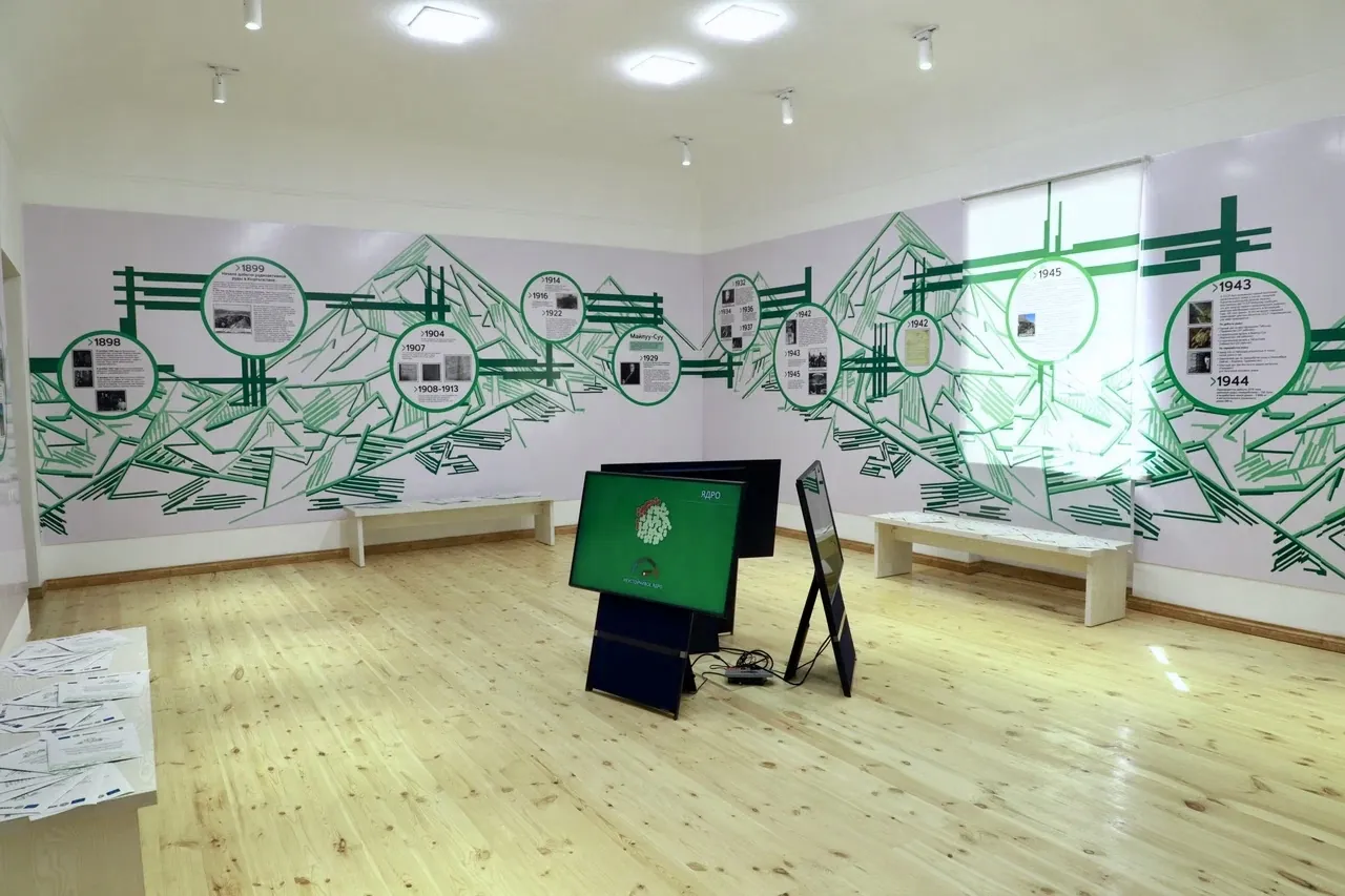 The museum explains the city’s industrial history and radiation-safety work. Photo: Tenzin doma lama, Wikimedia Commons, CC BY-SA 4.0; edited for this site.
Altitude. The city stands roughly 900-1,000 m above sea level. Its shape matters more than the figure: neighbourhoods follow the river, while steep slopes are exposed to erosion and landslides.
How industry created the city
Uranium ore was mined and processed in Mailuu-Suu from 1946 to 1968. The combine supplied the Soviet atomic programme and handled imported as well as local ore. Workers’ housing, roads, public buildings and restricted industrial infrastructure developed alongside it.
Older documents and Soviet maps use the name Maili-Sai. In 1992 the official name was clarified as Mailuu-Suu. The former spelling remains useful when searching archives, historical photographs and family records.
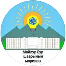 1/2. The lamp on the coat of arms recalls the city’s main factory Photo: Mailuu-Suu, Wikimedia Commons, public domain; edited for this site.
 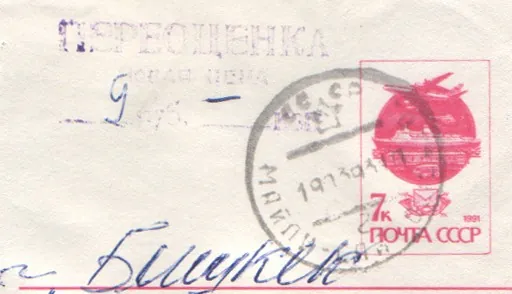 2/2. The former name Maili-Sai on a 1993 postal item Photo: Leonid 2, Wikimedia Commons, public domain; edited for this site.
 The electric lamp factory became important after the uranium combine. Construction and production began in 1964, and the lamp became part of the city’s coat of arms. The plant still defines the skyline, but it is not an open visitor attraction. View it from a public street unless you have a confirmed, authorised tour.
The city and uranium legacy museum
The museum opened on 16 June 2022. Its exhibition links the city’s history with uranium production, remediation and radiation safety. It is the right place to begin because diagrams and residents’ accounts provide context that a casual walk past old buildings cannot.
Before travelling, confirm the opening day, tour time and address with the museum or city administration. No dependable current timetable is published in the official sources we found, and access may depend on events. If the museum is closed, do not replace it with an independent search for industrial sites.
Tailings sites and current remediation
A tailings site stores finely crushed material left after ore processing. Mailuu-Suu has 23 tailings sites and 13 mine-waste dumps, holding about 3 million m³ of material in total. Some lie close to the river and slopes, which makes erosion, floods and landslides part of the environmental risk.
Remediation is in progress. The project is designed to stabilise and cover more than 2 million m³ of tailings, with about 350 thousand m³ due to be moved to a prepared disposal site. Access roads and work areas can change as the project advances, so treat every fence, barrier and warning sign as a boundary.
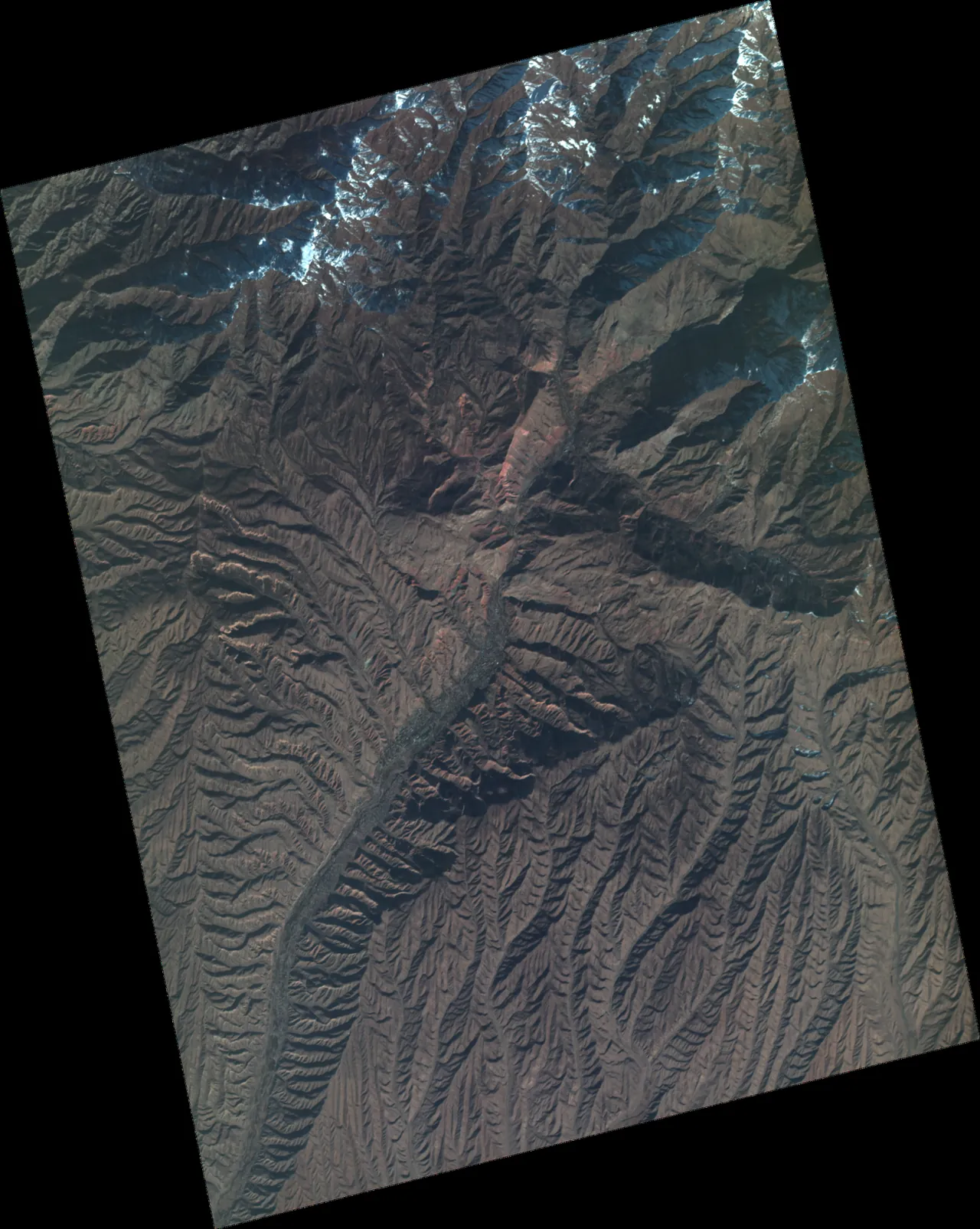 The satellite view reveals the valley’s long, narrow shape. Photo: Wyvern Inc., Wikimedia Commons, CC BY 4.0; edited for this site.
Leave a safety margin: stay on public streets, never climb a fence, do not collect stones or soil from industrial land, keep out of adits and avoid descending to the river over loose slopes. An ordinary residential block and a marked uranium legacy site call for different precautions, so follow official signs and local restrictions.
What to see in the city
The central streets. This is the simplest place to read the post-war townscape, buy water and food, find a taxi and ask for the museum. Begin in the residential centre rather than at an unmarked industrial turn-off.
The river valley. Mailuu-Suu makes sense from an accessible road above the neighbourhoods, where homes and plants occupy a narrow strip between water and slopes. Choose a proper stopping place and never park beneath loose rock or on a service road.
Industrial architecture. Factory blocks, workers’ housing and municipal buildings show how rapidly the Soviet industrial city was built. Observe them from public space. A derelict appearance does not grant access or prove that a building is structurally sound.
A half-day or full-day plan
Half a day. Visit the museum first, then walk through the centre and find an authorised view along the valley. Leave time for your return transport. This route gives you history, urban scale and landscape without unsafe detours.
One day. Add an unhurried walk through residential streets, lunch and several stops along public roads. Arrange a visit with the museum or an official local guide in advance if you want a deeper discussion of the industrial legacy. A casual driver cannot provide permission to enter a restricted site.
Mailuu-Suu works best within a wider Jalal-Abad Region itinerary. Manas is a useful base before the trip; afterwards you can continue towards Tash-Kumyr or give separate days to Sary-Chelek. These places do not fit comfortably into one short day of driving.
Getting there, when to go and where to stay
From Manas, the road runs west through Bazar-Korgon and Kochkor-Ata before turning north into the Mailuu-Suu valley. From Osh, travellers usually pass through Manas or change transport along the way. Minibuses and shared taxis may change departure points and wait until full, so confirm the stop, fare and return service on the day. Our Kyrgyzstan transport guide explains the usual options.
In spring, green slopes come with heavier erosion and falling-rock risk after rain. In summer, walk in the morning or evening and carry water. Autumn is comfortable until the days become short. In winter, check snow, ice and road conditions before setting out.
For a half-day visit, it is usually easier to return to Manas or stay in Kochkor-Ata. If you sleep in Mailuu-Suu, confirm heating, hot water, late arrival and a morning taxi before booking. Choose accommodation in a residential part of town rather than simply selecting the nearest map marker.
Share on social media
If you found this guide useful, share it on social media. It takes a moment and helps more travellers discover the project. Thank you!
Anything to add?
Share your experience, leave a comment or suggest an improvement.