Contents:
Why visit Alamedin Gorge?
Alamedin begins close to Bishkek's southern edge but quickly opens into a real mountain landscape: a broad river valley, rocky sides and snowy peaks deep in the Kyrgyz Ala-Too. It has less park infrastructure than Ala-Archa, which makes a visit feel less managed but demands more self-reliance.
For a first walk. Follow the valley for an hour or two and return without needing a fixed destination. The lower section gains height gradually, although the path is not improved everywhere and includes stones, wet ground and descents towards the river.
For a day hike. Teke-Tor waterfall is about 5.7 kilometres from the usual starting point. The route gains roughly 370 metres and takes a little over two hours to the waterfall without long stops. The return journey and a break make this a full day out.
Not for chasing rare wildlife. The gorge belongs to a large mountain ecosystem, but snow leopards avoid people and are not a tourist attraction. Livestock on pasture, birds of prey and seasonal flowers are much more realistic sightings.
Not for an improvised trip to the lakes. Altyn-Tor and other high-altitude lakes lie far beyond the normal day route. Reaching them involves camping, altitude, river crossings and navigation. They cannot be added to the waterfall as one more short stop.
How to reach Alamedin Gorge
From Bishkek, drive south-east through Kok-Jar, Besh-Küngöy, Tash-Moynok and Koy-Tash. In Koy-Tash, the road to Gornaya Mayovka branches away; continue towards the Tyoplye Klyuchi complex for Alamedin. The journey from the centre is about 35 kilometres and roughly an hour without congestion.
The paved road reaches the upper approach, so a roadworthy ordinary car is sufficient. There is no dependable scheduled public transport to the trailhead. A car booked for the return journey or a transfer from a tour company is easier. Keep the driver's contact details and agree on the precise meeting point.
The coordinates on this page mark the general starting area for walks, not the waterfall. The sanatorium, hotels and fenced properties nearby operate under their own rules. Do not cross a private yard to shorten the route or park in front of gates.
A detailed description of the Teke-Tor route, including distance, height gain and turns, appears in the Hiking.kg catalogue. Download the track before leaving. The main trail is fairly clear beyond the bridge, but side roads and shepherd paths can lead into a neighbouring valley.
What to know about Alamedin and Tyoplye Klyuchi
Russian-language maps use both Alamedin and Alamüdün for the river, gorge and district east of Bishkek. A confident translation of the name as "covered with forest" lacks a dependable linguistic source, so it should not be used as the basis of the place's history.
The Alamedin River rises in the glaciated part of the Kyrgyz Ala-Too and flows through the gorge, foothills and Bishkek. Water levels are higher in spring and early summer, and heavy rain can quickly change a calm stream. Do not camp in a dry channel or cross when the water becomes cloudy or begins to rise.
The Tyoplye Klyuchi area is known for mineral springs and sanatorium complexes. A pool visit or treatment is not automatically part of a hike. Confirm hours, prices and rules with the particular establishment. A specialist, not a travel article, should assess the water's composition and medical indications.
A hot spring does not make river water safe to drink. Carry water from town or use a reliable purification system. Run-off from livestock adds a microbiological risk around pastures.
How to hike to Teke-Tor waterfall
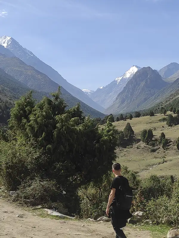 1/4. Alamedin Gorge
 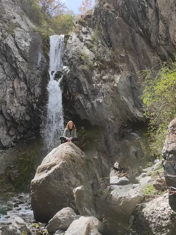 2/4. Teke-Tor waterfall
 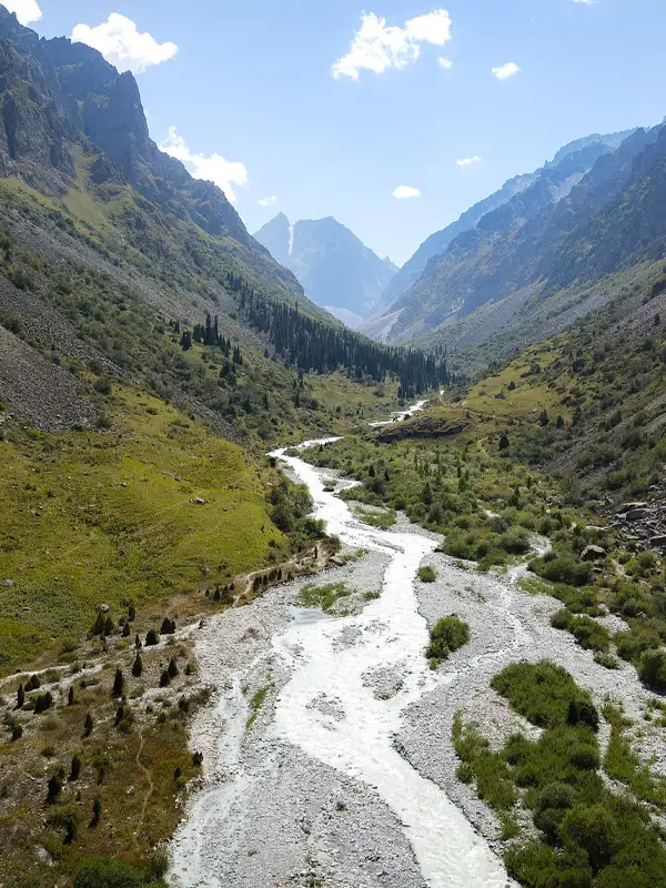 3/4. Alamedin River
 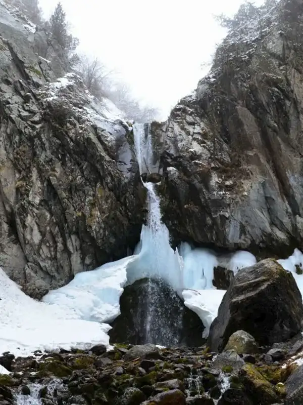 4/4. Teke-Tor in winter
 First section. Descend from the parking area to the bridge and cross to the left bank as you face upstream. The trail then follows the river for most of the way. Do not replace the bridge with a ford when the water is high.
Main valley. The gradient is moderate, but the distance accumulates. Follow your track and note landmarks for the return. Open sections have little shelter from sun or wind. Bring a hat in summer, and gloves plus an extra layer in autumn.
Final climb. Turn into a side gorge and gain height on a steeper path to reach the waterfall. Stones become slippery after rain; winter demands experience on ice and suitable equipment. Do not walk below falling ice or stand at the foot of the waterfall during a thaw.
Turnaround plan. Start in the morning and set a time when you will return regardless of the remaining distance. Carry water, food, waterproofs, a torch, first-aid kit and charged phone. Tell someone your route and check-in time; call 112 in an emergency.
Dry days from late spring to early autumn are best for an ordinary hike. Winter remains possible only with short daylight, ice and cold shade in mind. If the weather deteriorates, a walk in the lower valley is still a worthwhile trip rather than a failed attempt.
Share on social media
If you found this guide useful, share it on social media. It takes a moment and helps more travellers discover the project. Thank you!
Anything to add?
Share your experience, leave a comment or suggest an improvement.