Contents:
Why visit Ak-Tyuz?
Ak-Tyuz reveals Kyrgyzstan's industrial history in the landscape itself. The settlement grew beside the Kutessay-II and Kalesay deposits, a processing plant, quarries and ore roads. Mountains and stands of birch now share the valley with abandoned buildings and facilities that require environmental control.
This is not an ordinary tourist gorge. There is no marked network of walking trails, managed nature park or confirmed safe route through the old mine. View the valley from the public road and the inhabited part of the settlement without entering industrial sites.
White slopes are not souvenirs. Their colour reflects the deposits' complex geology, but appearance cannot tell you a rock's composition or safety. Do not take stones or soil home, touch dust on waste heaps or use unknown clay as a cosmetic.
The industrial story continues. Ak-Tyuz cannot be described only as an abandoned Soviet site. In 2025, the Ministry of Natural Resources reported new exploration at Kutessay-II and plans to assess rare-earth reserves. Access roads and the status of individual sites may therefore change.
How to reach Ak-Tyuz
From Bishkek, drive east towards the Boom corridor, then turn in Kemin District towards Orlovka and the Kichi-Kemin valley. Ak-Tyuz is about 150 to 160 kilometres away, depending on your starting point. Allow for traffic, roadworks and weather instead of assuming a fixed two-hour journey.
The main approach to the settlements follows an ordinary road. A four-wheel-drive vehicle does not give permission to turn towards a quarry, tailings facility or old service track. Barriers, fences and warning signs apply to every vehicle.
Ak-Tyuz lies north of Issyk-Kul and is not on the usual resort route. Do not treat it as a quick detour from the shore of Issyk-Kul without a separate day and a road check. Winter brings early darkness, snow and ice to the narrow valley, while heavy rain can wash out sections.
Arrange a local guide or someone familiar with the current industrial boundaries before travelling. Bring food and water from town. Do not drink from streams, wash dishes in them or camp below waste heaps and tailings facilities.
How Ak-Tyuz became an industrial settlement
Mining in the valley began in the late 1930s and the 1940s. The area was first associated with lead and polymetallic ores; later, Kutessay-II became an important source of rare-earth material for Soviet industry. The settlement, plant and transport infrastructure expanded with production.
The former system stopped after the Soviet Union dissolved, but its physical traces remained. Ak-Tyuz contains abandoned buildings, quarries, waste heaps and four tailings facilities. They stored residues from ore processing, so the romance of urban exploration must give way to industrial and environmental safety.
An official Ministry of Emergency Situations assessment places the four tailings facilities of the Ak-Tyuz processing plant in the first hazard category. Thorium, cadmium, zinc, lead and molybdenum are listed as pollutants, with flooding and slope erosion among the risks. The table appears in the ministry's material on Chüy Region.
The state is also reassessing the Kutessay-II reserves. Kyrgyzstan's Ministry of Natural Resources says exploration will take several years, after which decisions on processing and rehabilitation will follow. Treat old claims of unrestricted access as information that can quickly become outdated.
What can you see without taking unnecessary risks?
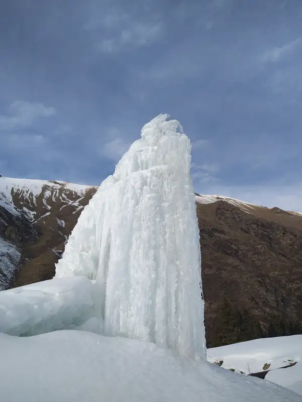 1/4. Winter ice formation
 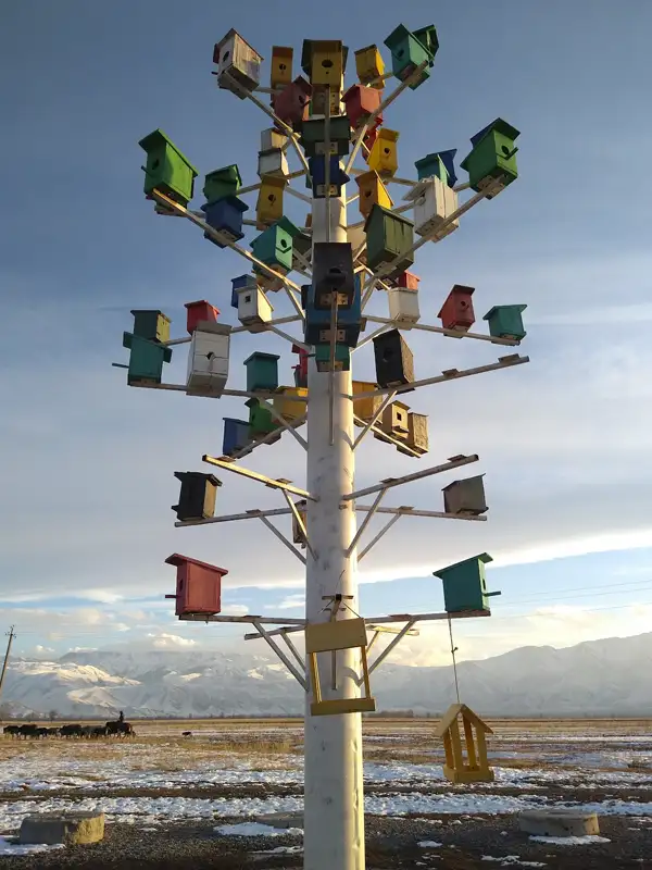 2/4. A detail of the valley
 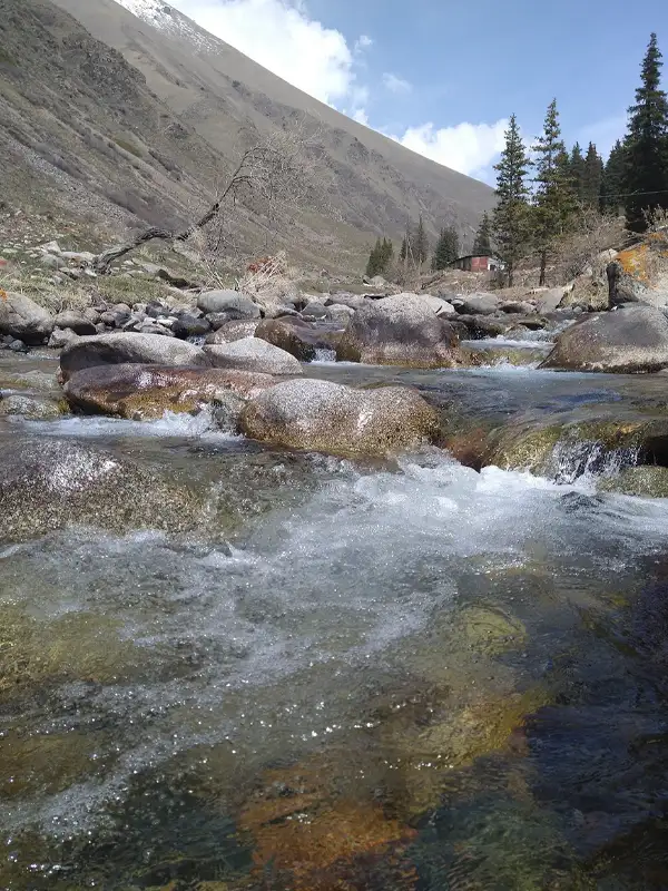 3/4. Stream in the valley
 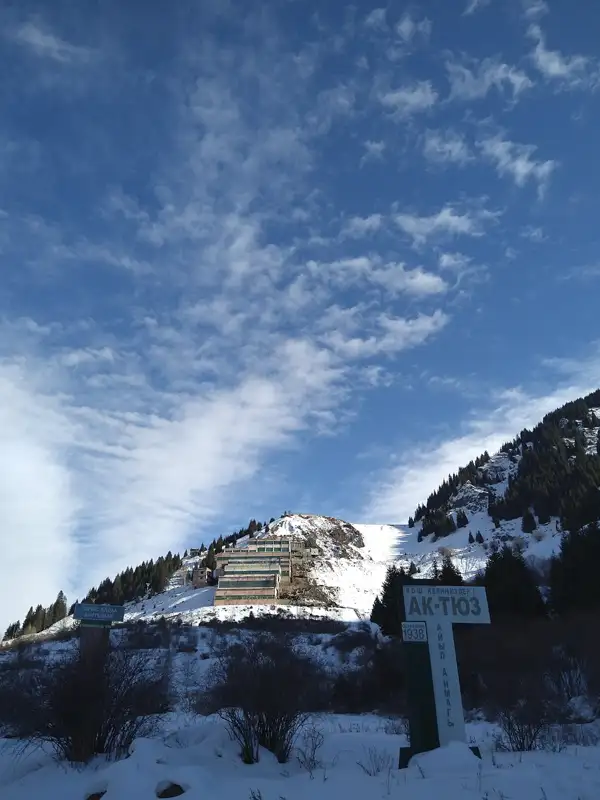 4/4. Industrial heritage
 The settlement and valley. The public road reveals the layout of an industrial community: homes, old production buildings and service roads on the slopes. Take photographs without entering fenced land or disturbing residents.
Abandoned buildings. View them from outside. Collapsed floors, unsecured structures, broken glass and industrial dust may be present. The absence of a fence does not make entry lawful or safe.
Winter ice formations. A water outlet that looks like a high fountain in photographs freezes into a conspicuous ice column. Do not stand below overhanging ice or cross the stream on a thin crust. You cannot judge the source or quality of the water by tasting it.
Mountain scenery. Birch stands and side valleys are visible without climbing towards the quarry. A separate hike needs a local route that reliably avoids tailings facilities, waste heaps and active exploration. Do not gather mushrooms or plants near industrial sites.
Share on social media
If you found this guide useful, share it on social media. It takes a moment and helps more travellers discover the project. Thank you!
Anything to add?
Share your experience, leave a comment or suggest an improvement.