Contents:
What a trip to Sutuu-Bulak involves
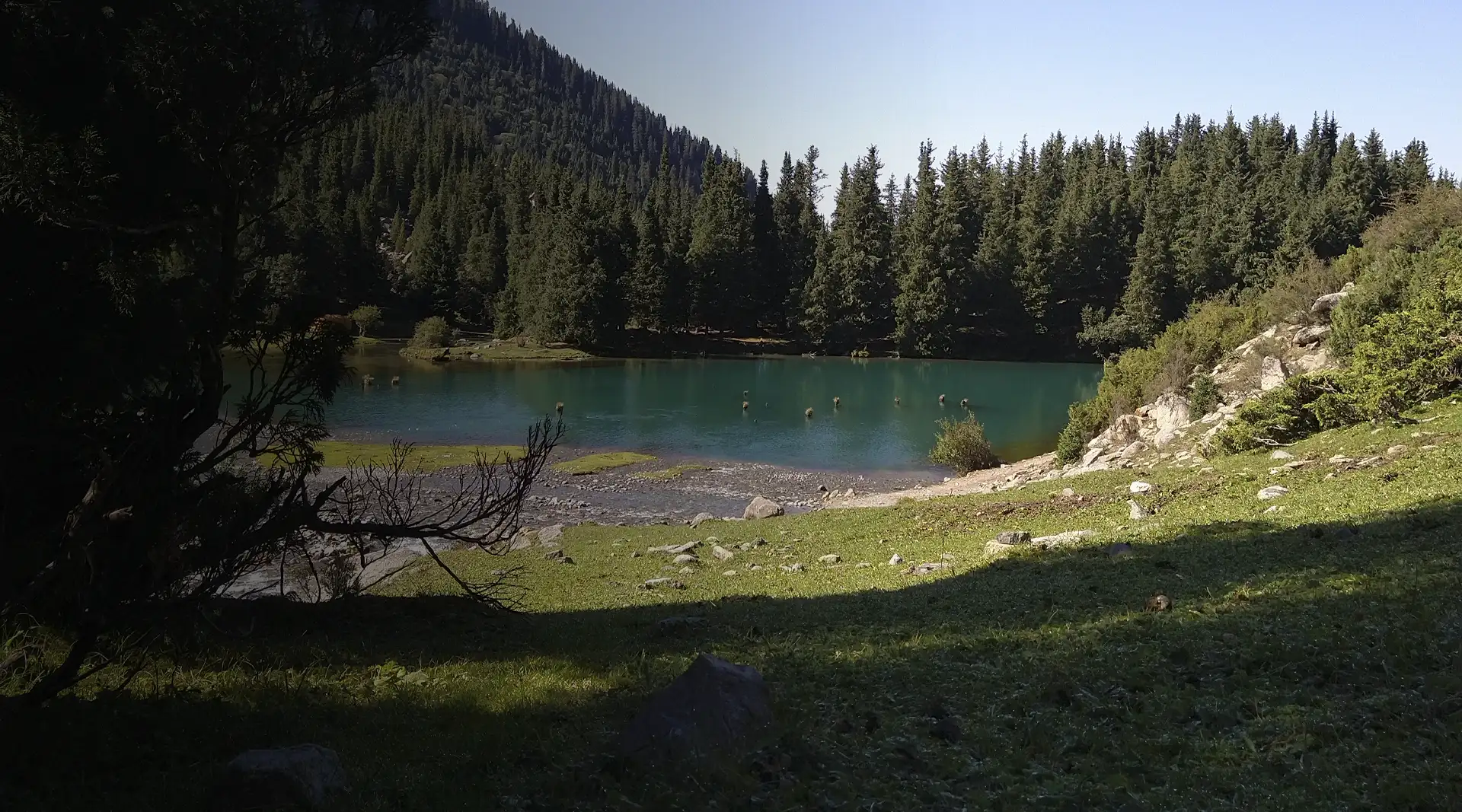
Choose Sutuu-Bulak for a short mountain hike rather than a beach. Spruce forest surrounds the small basin, old trunks rise from the water and its colour shifts from green to blue. An hour is enough at the lake, but the drive and walk occupy most of the day.
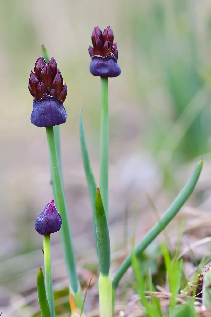 Spring flora on a juniper slope just above the lake, May 2018. Photo: Bogdan Kryzhatyuk, Wikimedia Commons, CC BY-SA 4.0; edited for this site.
The north shore of Issyk-Kul is a convenient starting point. Travel from Cholpon-Ata to Semenovka in the morning, then continue up the gorge with a local four-wheel-drive transfer. Plan to return before dark, as there is no marked urban trail, lighting or reliable reception here.
The route suits someone comfortable walking 10 kilometres in a day with roughly 500 metres of elevation gain. No mountaineering skills are required, but wet stones, mud and altitude call for proper footwear and extra time.
How to get to Lake Sutuu-Bulak
Turn off the north-shore road into Semenovka village and continue through Semenovka Gorge, also known as Kyrchyn. The paved surface ends, and conditions on the dirt road depend on rain, repairs and livestock movement.
The end of the driving section is not fixed. A suitably equipped vehicle can continue farther in dry weather, while a driver will stop earlier after heavy rain. Do not attempt to reach someone else's parking point in an ordinary car.
From a typical parking place, the lake is about 5 kilometres and two hours' walk each way, with roughly 500 metres of elevation gain. These estimates come from the Hiking.kg route catalogue, but check them with your driver or guide before setting out.
An older description promised a distance of eight kilometres from Semenovka to the lake itself and 3-4 hours of walking for the full route. That estimate mixed the driving and walking sections and could leave a traveller without enough time to return.
The name and confirmed facts
In Kyrgyz, Sutuu-Bulak is related to the phrase “milky spring”. The name suits the water's cloudy blue appearance, although its colour changes with the light, precipitation and suspended particles. Maps use the forms Суттуу-Булак, Сүттүү-Булак and Sutuu-Bulak.
The lake lies at an elevation of roughly 2,700 metres. Its exact depth and dimensions are not confirmed by modern measurements in accessible primary sources, so the claimed depth of “20 metres” is better left unstated.
Popular guidebooks repeat that the lake formed after the “1910 Verny earthquake”. The date is doubtful: the destructive Verny earthquake occurred in 1887, while the Kemin earthquake struck in early 1911. Until a geological source links a particular event to the lake, it is more honest not to assign it a year of birth.
The submerged trunks show that water covered part of an old forest. Observe them from stable ground. Do not enter the water or attempt to walk along the wet logs.
Season and preparation
The usual season runs from June to September. Snow may remain on the upper section in early summer, the road and trail become muddy after rain, and daylight shortens quickly in autumn. A forecast for the Issyk-Kul shore does not describe the weather at 2,700 metres.
Bring closed hiking boots, waterproof clothing, a warm layer, water, food, a first-aid kit, torch and charged phone with an offline map. Drink lake and stream water only after filtering and treating it.
The route crosses pasture and forest. Close gates, do not approach livestock and give sheepdogs a wide berth. A fire is dangerous in dry conifer litter, and you must carry packaging and wet wipes back out.
If the road is closed or cloud descends into the gorge, leave the lake for another day and walk in the lower part of Kyrchyn instead. A small destination is not worth driving across a muddy slope after dark.
Share on social media
If you found this guide useful, share it on social media. It takes a moment and helps more travellers discover the project. Thank you!
Anything to add?
Share your experience, leave a comment or suggest an improvement.